
MyTopo
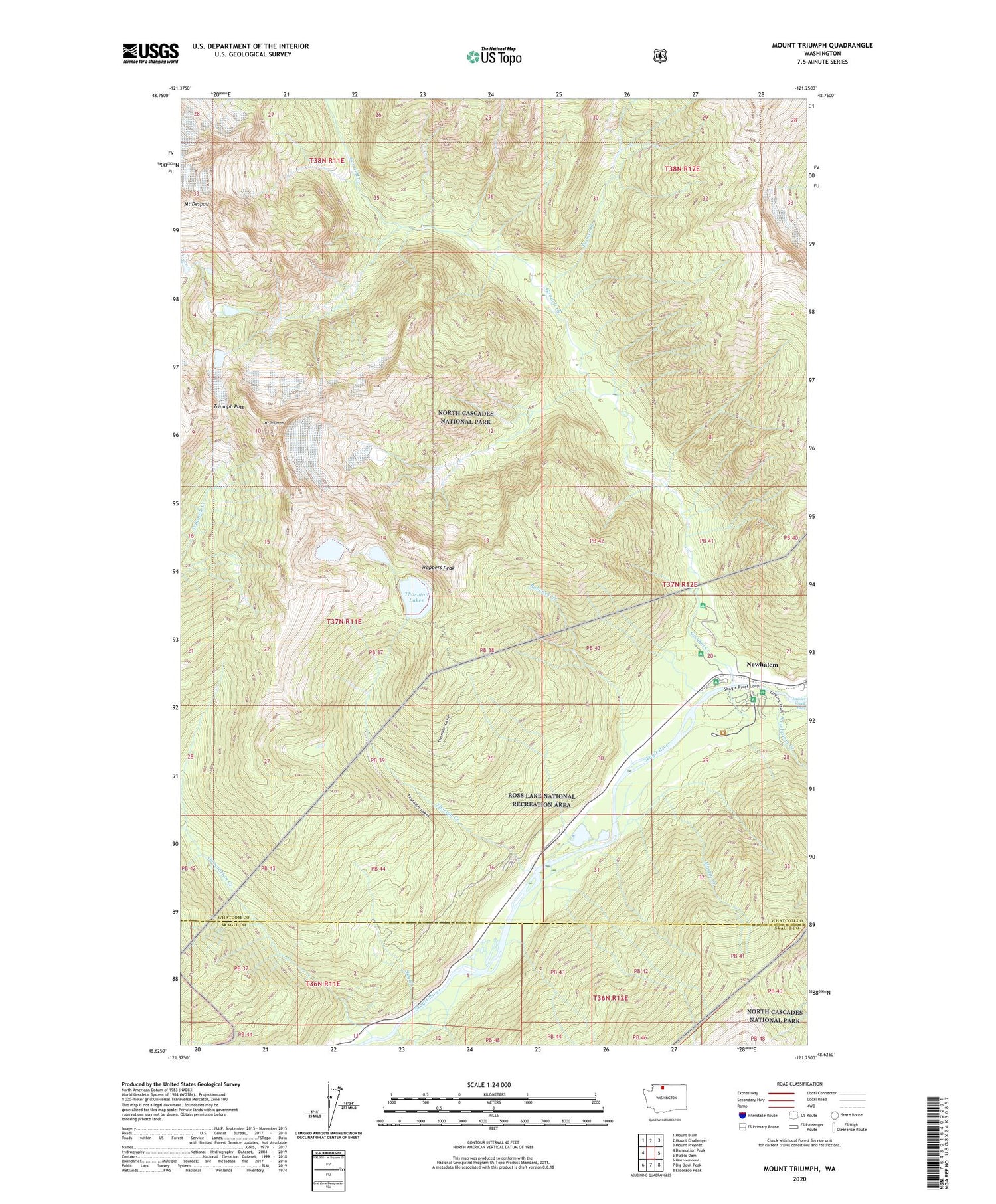
Mount Triumph Washington US Topo Map
Couldn't load pickup availability
Also explore the Mount Triumph Forest Service Topo of this same quad for updated USFS data
2023 topographic map quadrangle Mount Triumph in the state of Washington. Scale: 1:24000. Based on the newly updated USGS 7.5' US Topo map series, this map is in the following counties: Whatcom, Skagit. The map contains contour data, water features, and other items you are used to seeing on USGS maps, but also has updated roads and other features. This is the next generation of topographic maps. Printed on high-quality waterproof paper with UV fade-resistant inks.
Quads adjacent to this one:
West: Damnation Peak
Northwest: Mount Blum
North: Mount Challenger
Northeast: Mount Prophet
East: Diablo Dam
Southeast: Eldorado Peak
South: Big Devil Peak
Southwest: Marblemount
This map covers the same area as the classic USGS quad with code o48121f3.
Contains the following named places: Babcock Creek, Damnation Creek, Goodell Campground, Goodell Creek, Goodell Siding, Group Campground, Martin Creek, Mount Triumph, Newhalem / Diablo Volunteer Fire Department, Newhalem Campground, Newhalem Creek, Sky Creek, Sky Creek Siding, Terror Creek, Thornton Lakes, Thorton Creek, Trappers Peak, Triumph Pass


