MyTopo
Toleak Point Washington US Topo Map
Couldn't load pickup availability
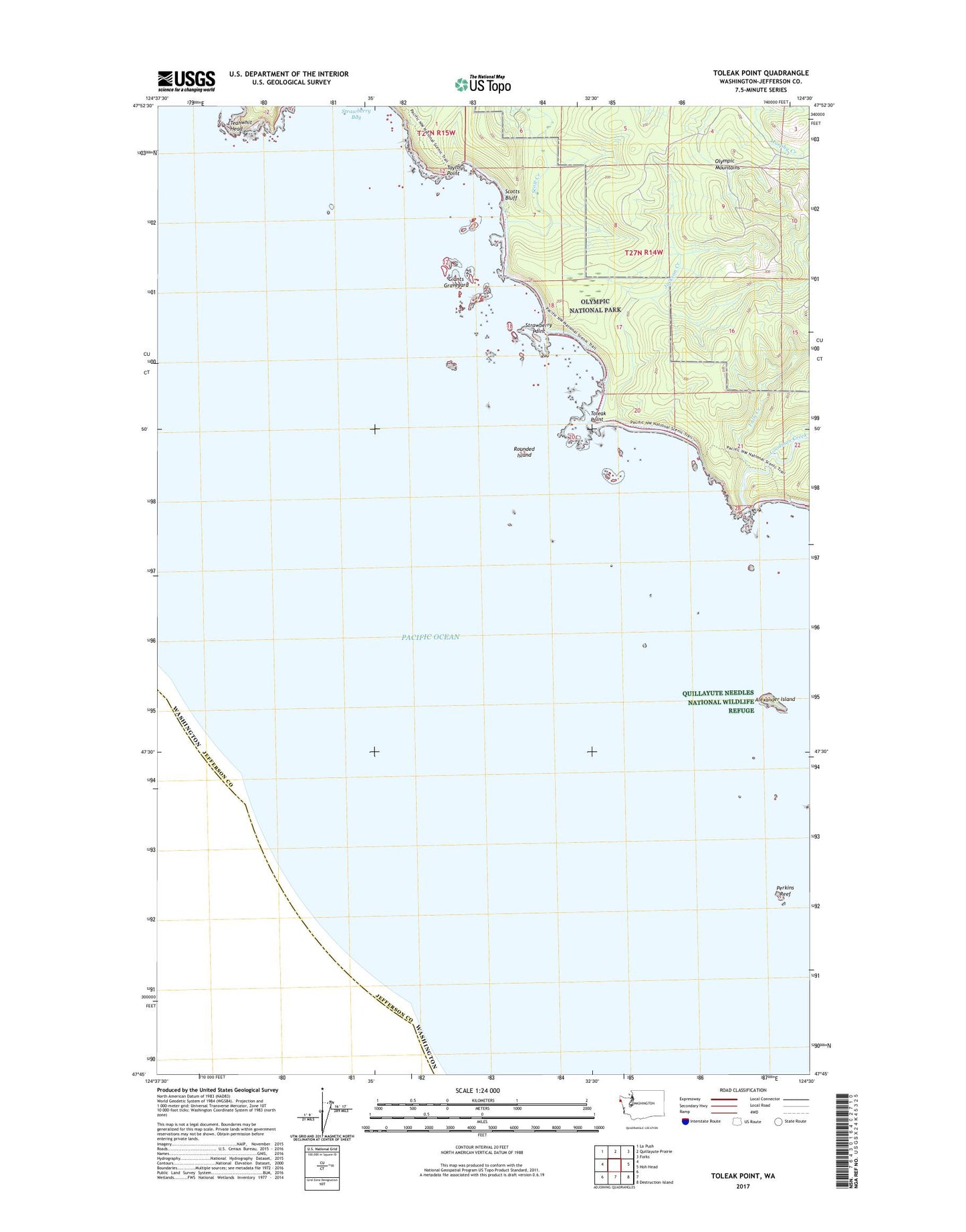
2023 topographic map quadrangle Toleak Point in the state of Washington. Scale: 1:24000. Based on the newly updated USGS 7.5' US Topo map series, this map is in the following counties: Jefferson. The map contains contour data, water features, and other items you are used to seeing on USGS maps, but also has updated roads and other features. This is the next generation of topographic maps. Printed on high-quality waterproof paper with UV fade-resistant inks.
Quads adjacent to this one:
Northwest: La Push
North: Quillayute Prairie
Northeast: Forks
East: Hoh Head
Southeast: Destruction Island
This map covers the same area as the classic USGS quad with code o47124g5.
Contains the following named places: Alexander Island, Falls Creek, Giants Graveyard, Goodman Creek, Jackson Creek, Perkins Reef, Quillayute Needles National Wildlife Refuge, Rounded Island, Scott Creek, Scotts Bluff, Strawberry Bay, Strawberry Point, Taylor Point, Teahwhit Head, Toleak Point