MyTopo
Dickey Lake Washington US Topo Map
Couldn't load pickup availability
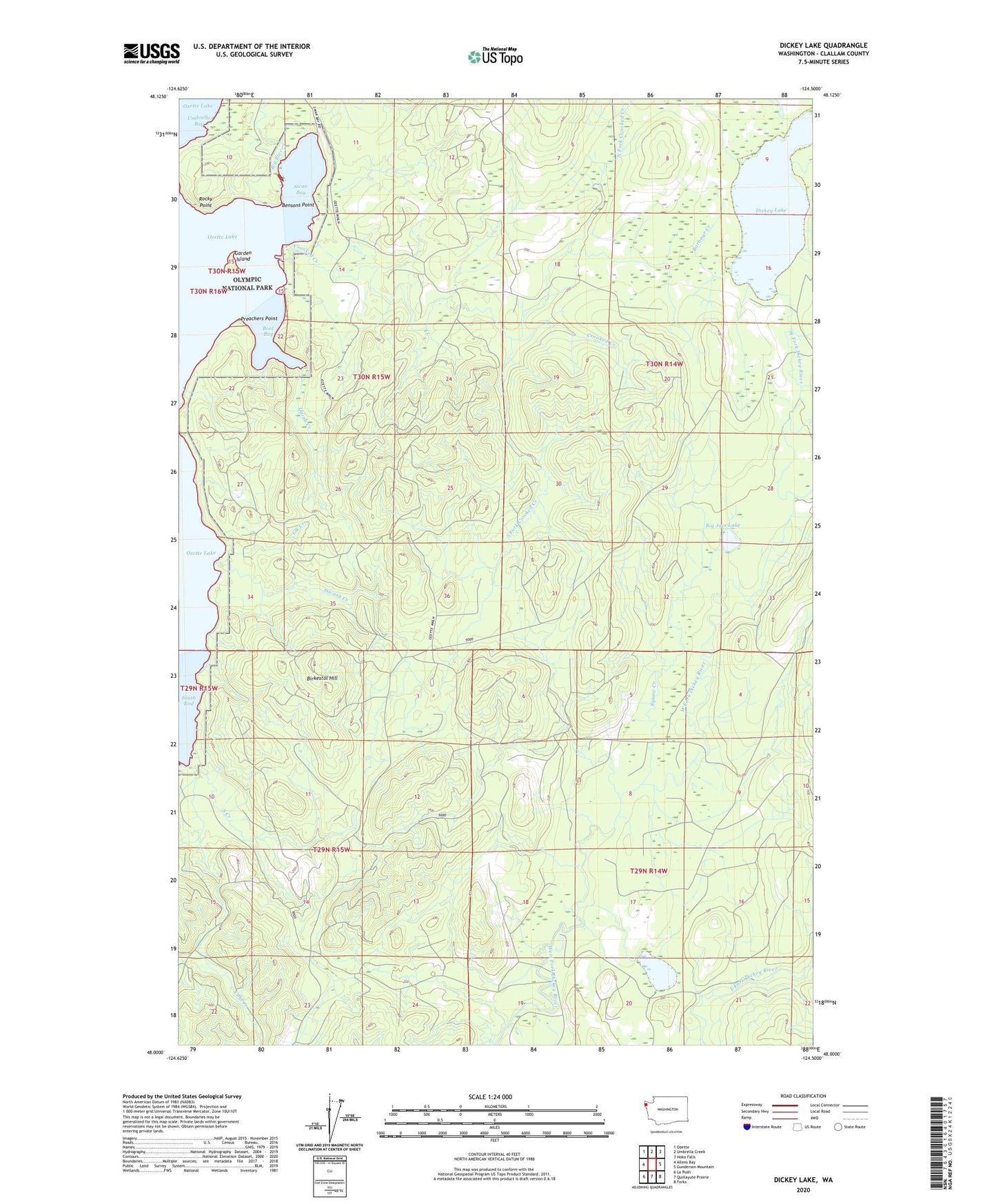
2023 topographic map quadrangle Dickey Lake in the state of Washington. Scale: 1:24000. Based on the newly updated USGS 7.5' US Topo map series, this map is in the following counties: Clallam. The map contains contour data, water features, and other items you are used to seeing on USGS maps, but also has updated roads and other features. This is the next generation of topographic maps. Printed on high-quality waterproof paper with UV fade-resistant inks.
Quads adjacent to this one:
West: Allens Bay
Northwest: Ozette
North: Umbrella Creek
Northeast: Hoko Falls
East: Gunderson Mountain
Southeast: Forks
South: Quillayute Prairie
Southwest: La Push
This map covers the same area as the classic USGS quad with code o48124a5.
Contains the following named places: Barbour Creek, Bensons Point, Big Joes Lake, Big River, Birkestol Hill, Boot Bay, Crooked Creek, Dickey Lake, Elk Creek, Garden Island, Middle Fork Dickey River, North Fork Crooked Creek, Preachers Point, Quinn Creek, Rocky Point, Sands Creek, Siwash Creek, South Creek, South Fork Crooked Creek, Squaw Creek, Stampede Creek, Swan Bay, Umbrella Bay, Wentworth Lake