MyTopo
Quillayute Prairie Washington US Topo Map
Couldn't load pickup availability
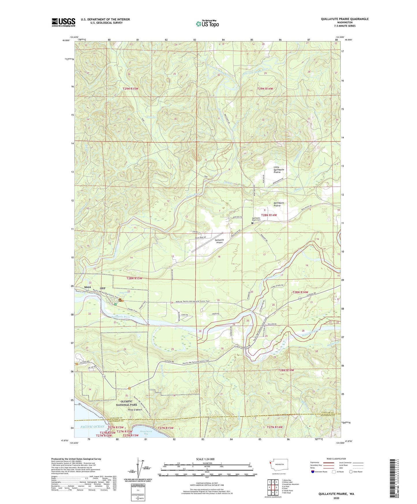
2023 topographic map quadrangle Quillayute Prairie in the state of Washington. Scale: 1:24000. Based on the newly updated USGS 7.5' US Topo map series, this map is in the following counties: Clallam, Jefferson. The map contains contour data, water features, and other items you are used to seeing on USGS maps, but also has updated roads and other features. This is the next generation of topographic maps. Printed on high-quality waterproof paper with UV fade-resistant inks.
Quads adjacent to this one:
West: La Push
Northwest: Allens Bay
North: Dickey Lake
Northeast: Gunderson Mountain
East: Forks
Southeast: Hoh Head
South: Toleak Point
This map covers the same area as the classic USGS quad with code o47124h5.
Contains the following named places: Bogachiel River, Coal Creek, Colby Creek, Dickey River, East Fork Dickey River, Franklin Creek, James Park, James Pond, Larger Creek, Leyendecker Boat Ramp, Leyendecker Picnic Area, Little Quillayute Prairie, Maxfield Creek, Mora, Mora Campground, Mora Ranger Station, Murphy Creek, Naval Auxiliary Air Station Quillayute, Newbert Creek, Quileute Reservation, Quillayute, Quillayute Airport, Quillayute Prairie, Quillayute Prairie Cemetery, Quillayute Quarry, Sol Duc River, Three D Beach, Thunder Field, West Fork Dickey River, ZIP Code: 98350