MyTopo
Doe Mountain Washington US Topo Map
Couldn't load pickup availability
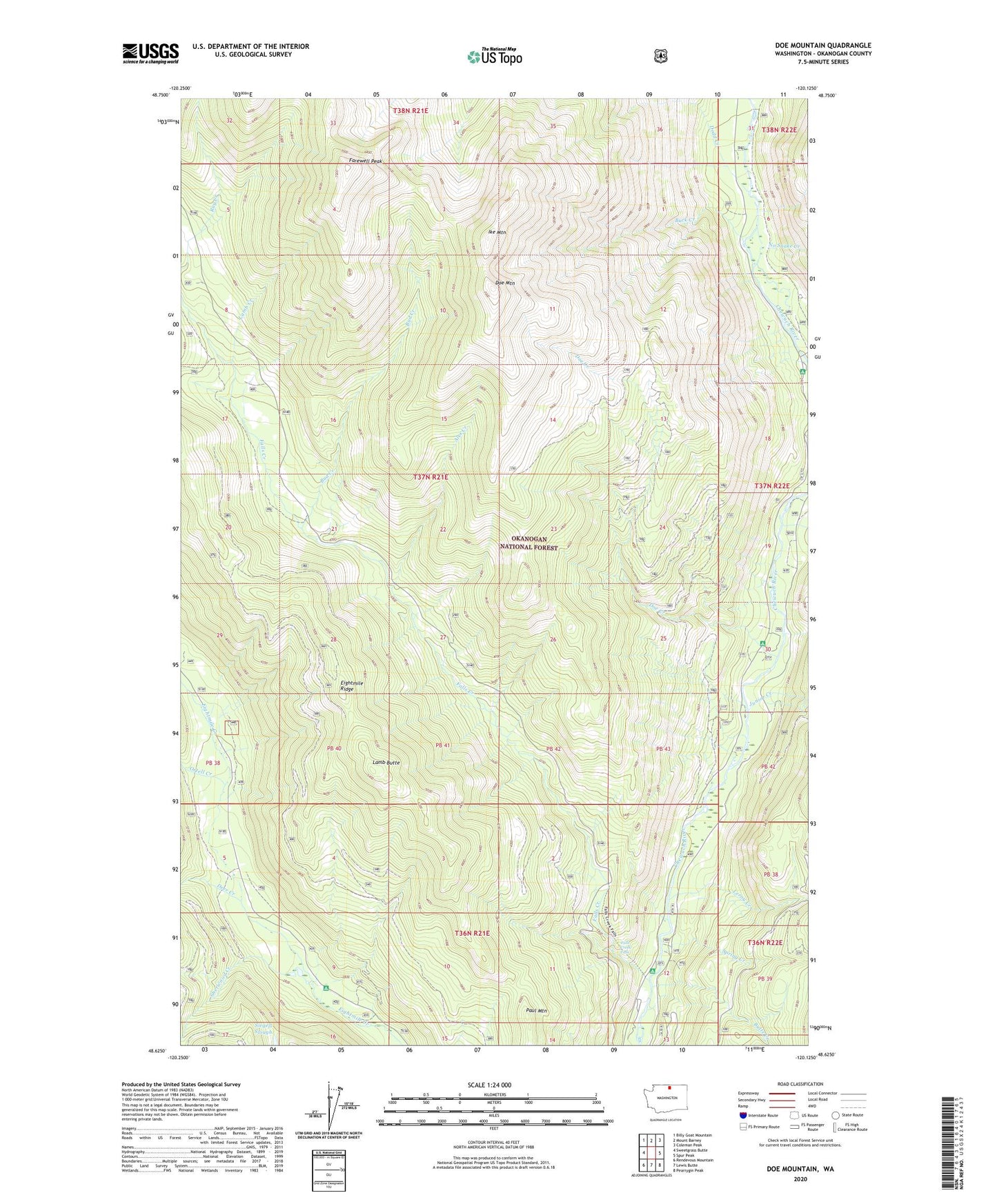
2020 topographic map quadrangle Doe Mountain in the state of Washington. Scale: 1:24000. Based on the newly updated USGS 7.5' US Topo map series, this map is in the following counties: Okanogan. The map contains contour data, water features, and other items you are used to seeing on USGS maps, but also has updated roads and other features. This is the next generation of topographic maps. Printed on high-quality waterproof paper with UV fade-resistant inks.
Quads adjacent to this one:
West: Sweetgrass Butte
Northwest: Billy Goat Mountain
North: Mount Barney
Northeast: Coleman Peak
East: Spur Peak
Southeast: Pearrygin Peak
South: Lewis Butte
Southwest: Rendevous Mountain
Contains the following named places: Alex Creek, Brevicomis Creek, Buck Creek, Bud Creek, Butte Creek, Camp Four Campground, Chewuch Campground, Deer Creek, Dodd Creek, Doe Creek, Doe Mountain, Falls Creek, Falls Creek Campground, Falls Creek Falls, Farewell Peak, Ike Mountain, Junior Creek, Lamb Butte, Lamb Creek, Leroy Creek, Nice Campground, No Snake Creek, Ortell Creek, Paul Mountain, Sherwood Creek, Spring Creek