MyTopo
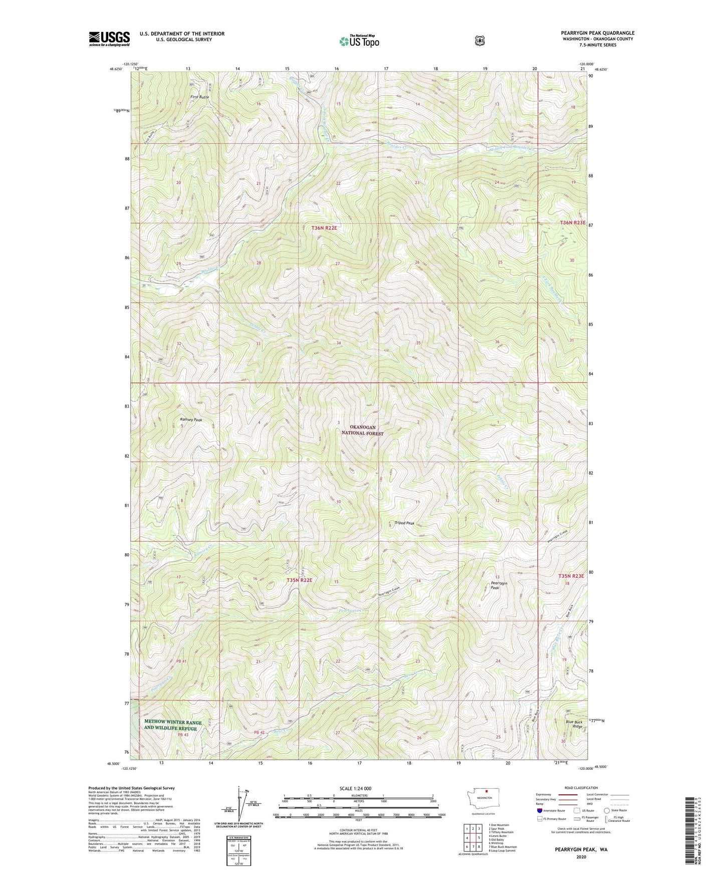
Pearrygin Peak Washington US Topo Map
Couldn't load pickup availability
Also explore the Pearrygin Peak Forest Service Topo of this same quad for updated USFS data
2023 topographic map quadrangle Pearrygin Peak in the state of Washington. Scale: 1:24000. Based on the newly updated USGS 7.5' US Topo map series, this map is in the following counties: Okanogan. The map contains contour data, water features, and other items you are used to seeing on USGS maps, but also has updated roads and other features. This is the next generation of topographic maps. Printed on high-quality waterproof paper with UV fade-resistant inks.
Quads adjacent to this one:
West: Lewis Butte
Northwest: Doe Mountain
North: Spur Peak
Northeast: Tiffany Mountain
East: Old Baldy
Southeast: Loup Loup Summit
South: Blue Buck Mountain
Southwest: Winthrop
This map covers the same area as the classic USGS quad with code o48120e1.
Contains the following named places: Baldy Creek, Bromas Creek, First Butte, Middle Fork Boulder Creek, North Fork Boulder Creek, Pearrygin Peak, Pearrygin Trail, Pebble Creek, Ramsey Peak, South Fork Boulder Creek, Tripod Peak