MyTopo
Dungeness Washington US Topo Map
Couldn't load pickup availability
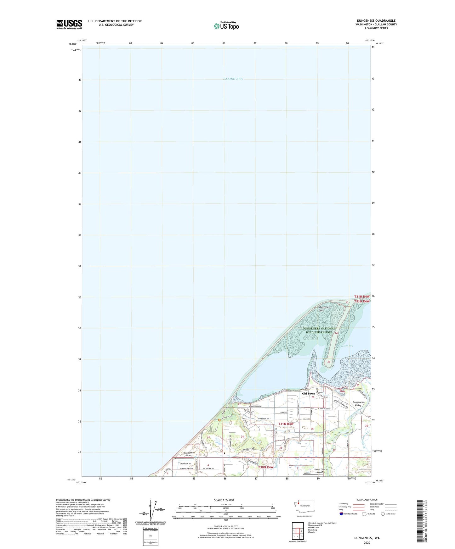
2023 topographic map quadrangle Dungeness in the state of Washington. Scale: 1:24000. Based on the newly updated USGS 7.5' US Topo map series, this map is in the following counties: Clallam. The map contains contour data, water features, and other items you are used to seeing on USGS maps, but also has updated roads and other features. This is the next generation of topographic maps. Printed on high-quality waterproof paper with UV fade-resistant inks.
Quads adjacent to this one:
East: Dungeness OE E
Southeast: Sequim
South: Carlsborg
Southwest: Morse Creek
This map covers the same area as the classic USGS quad with code o48123b1.
Contains the following named places: Blue Ribbon Airport, Cays Road Pit, Dungeness Bay, Dungeness National Wildlife Refuge, Dungeness Recreation Area, Dungeness Recreation Area Campground, Dungeness River, Dungeness Spit, Dungeness Valley, Five Acre School, KCDV-AM (Dungeness), Matriotti Creek, McDonald Creek, Meadowbrook Creek, New Dungeness Lighthouse Reservation, Old Town, Rake's Glen Airport, Swanton Ultralight Airport