MyTopo
Dungeness OE E Washington US Topo Map
Couldn't load pickup availability
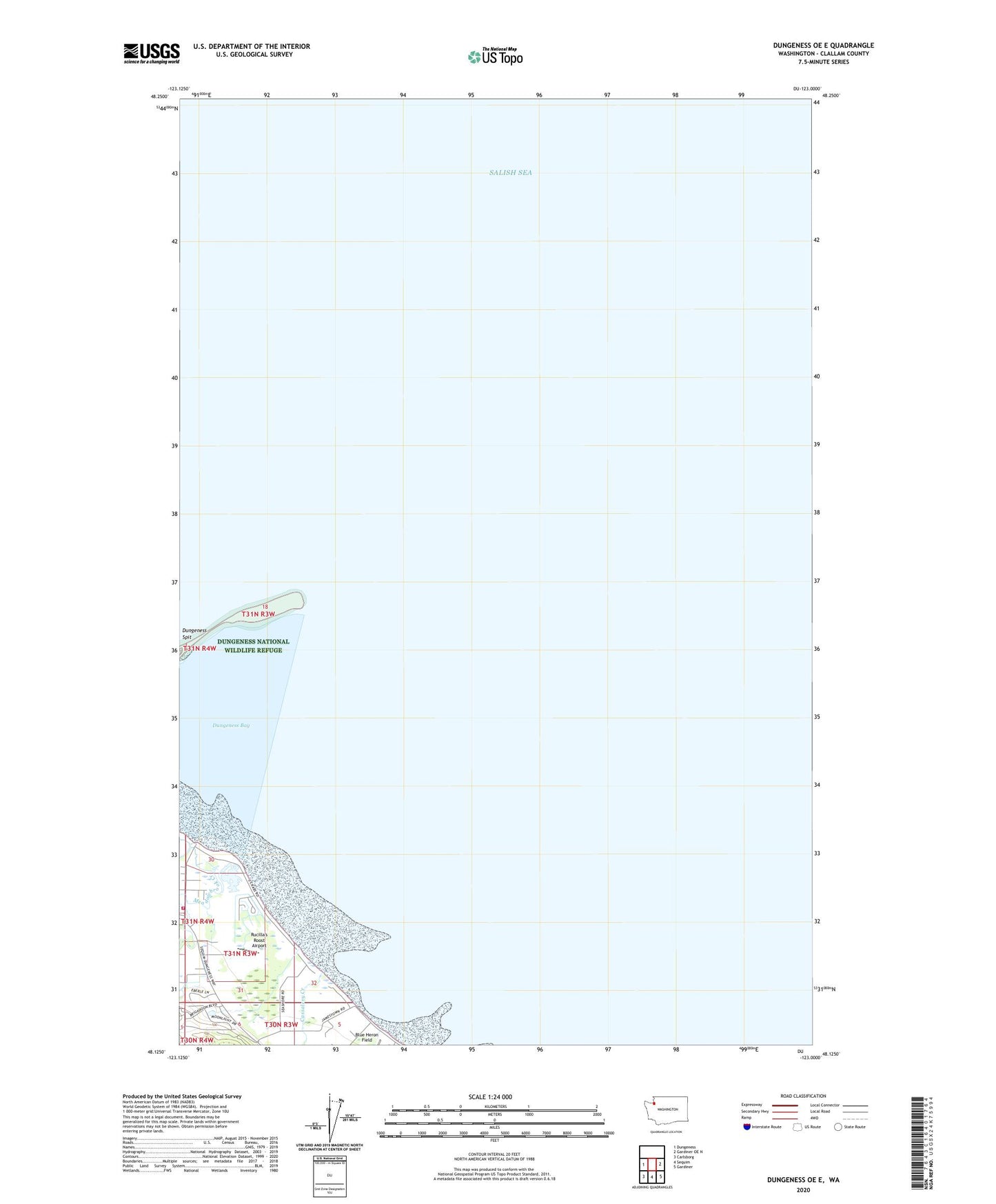
2023 topographic map quadrangle Dungeness OE E in the state of Washington. Scale: 1:24000. Based on the newly updated USGS 7.5' US Topo map series, this map is in the following counties: Clallam. The map contains contour data, water features, and other items you are used to seeing on USGS maps, but also has updated roads and other features. This is the next generation of topographic maps. Printed on high-quality waterproof paper with UV fade-resistant inks.
Quads adjacent to this one:
West: Dungeness
East: Gardiner OE N
Southeast: Gardiner
South: Sequim
Southwest: Carlsborg
Contains the following named places: Blue Heron Field, Cassalery Creek, Clallam County Fire District 3 Station 31 Dungeness, Dungeness, Dungeness Community Church, Dungeness Lighthouse, Jamestown, Kirner Pit, New Dungeness Lighthouse, Rucilla's Roost Airport