MyTopo
Othello Washington US Topo Map
Couldn't load pickup availability
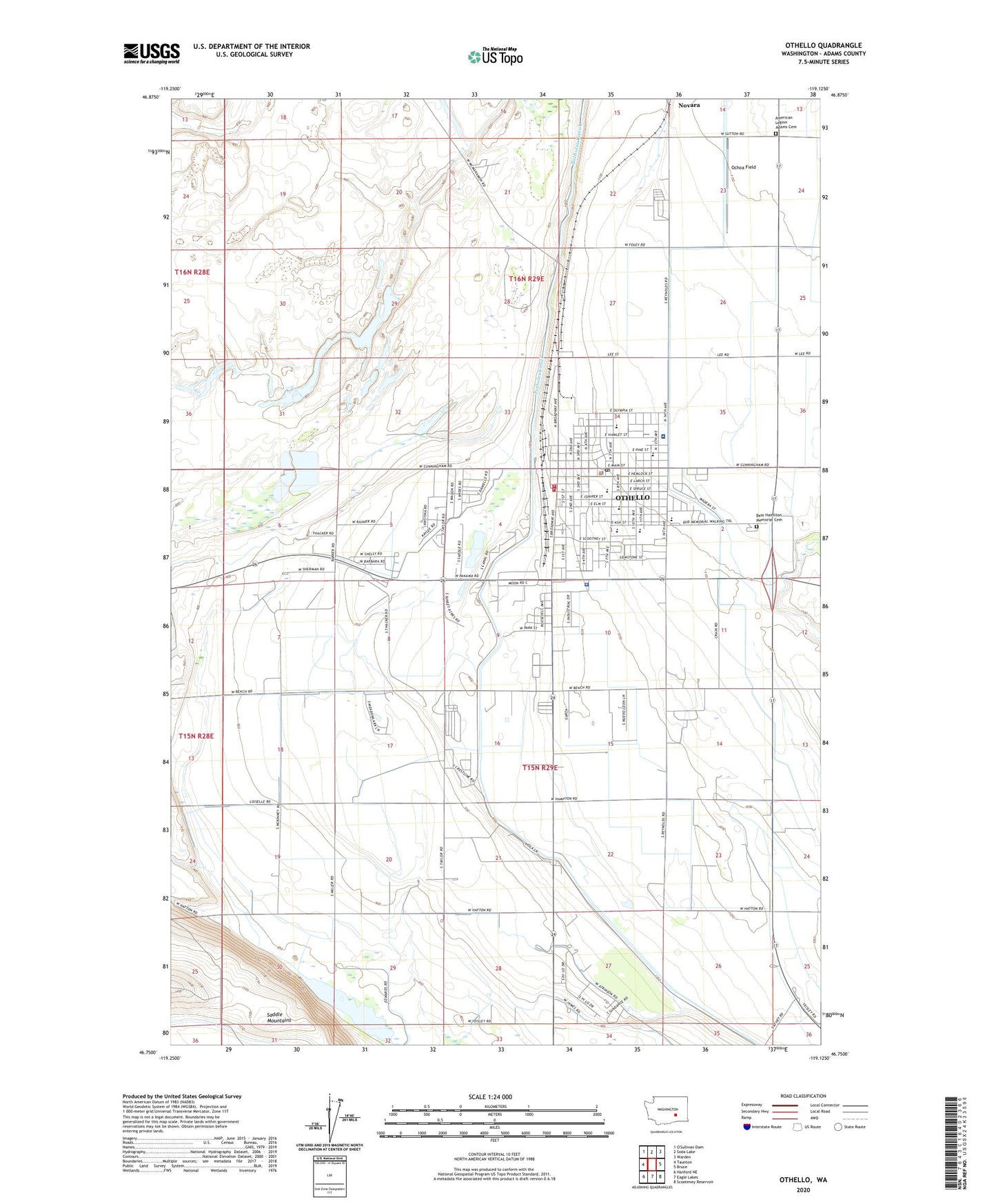
2023 topographic map quadrangle Othello in the state of Washington. Scale: 1:24000. Based on the newly updated USGS 7.5' US Topo map series, this map is in the following counties: Adams. The map contains contour data, water features, and other items you are used to seeing on USGS maps, but also has updated roads and other features. This is the next generation of topographic maps. Printed on high-quality waterproof paper with UV fade-resistant inks.
Quads adjacent to this one:
West: Taunton
North: Soda Lake
Northeast: Warden
East: Bruce
Southeast: Scooteney Reservoir
South: Eagle Lakes
Southwest: Hanford NE
This map covers the same area as the classic USGS quad with code o46119g2.
Contains the following named places: Adams County Fire District 5, Adams County Sheriff's Office Othello, American Legion Adams Cemetery, Bess Hamilton Memorial Gardens Cemetery, City of Othello, City of Othello Fire Station, Gearheart Private Airport, Hiawatha Elementary School, Kent Farms Airport, KRSC-AM (Othello), Lower Saddle Gap Pumping Station, Lutacaga Elementary School, McFarland Middle School, Ochoa Field, Othello, Othello Ambulance Service Othello Community Hospital, Othello Community Hospital, Othello High School, Othello Police Department, Othello Post Office, Scootney Springs Elementary School, Taggares Dam Number Four, Taggares Dam Number One, Taggares Dam Number Three, Taggares Dam Number Two, ZIP Code: 99344