MyTopo
Taunton Washington US Topo Map
Couldn't load pickup availability
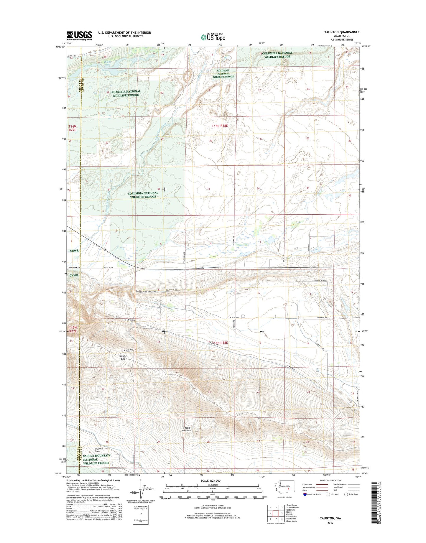
2023 topographic map quadrangle Taunton in the state of Washington. Scale: 1:24000. Based on the newly updated USGS 7.5' US Topo map series, this map is in the following counties: Adams, Grant. The map contains contour data, water features, and other items you are used to seeing on USGS maps, but also has updated roads and other features. This is the next generation of topographic maps. Printed on high-quality waterproof paper with UV fade-resistant inks.
Quads adjacent to this one:
West: Corfu
Northwest: Royal Camp
Northeast: Soda Lake
East: Othello
Southeast: Eagle Lakes
South: Hanford NE
Southwest: Locke Island
This map covers the same area as the classic USGS quad with code o46119g3.
Contains the following named places: Anson, KZLN-FM (Othello), Royal Lake, Saddle Gap, Taunton