
MyTopo
Ellis Mountain Washington US Topo Map
Couldn't load pickup availability
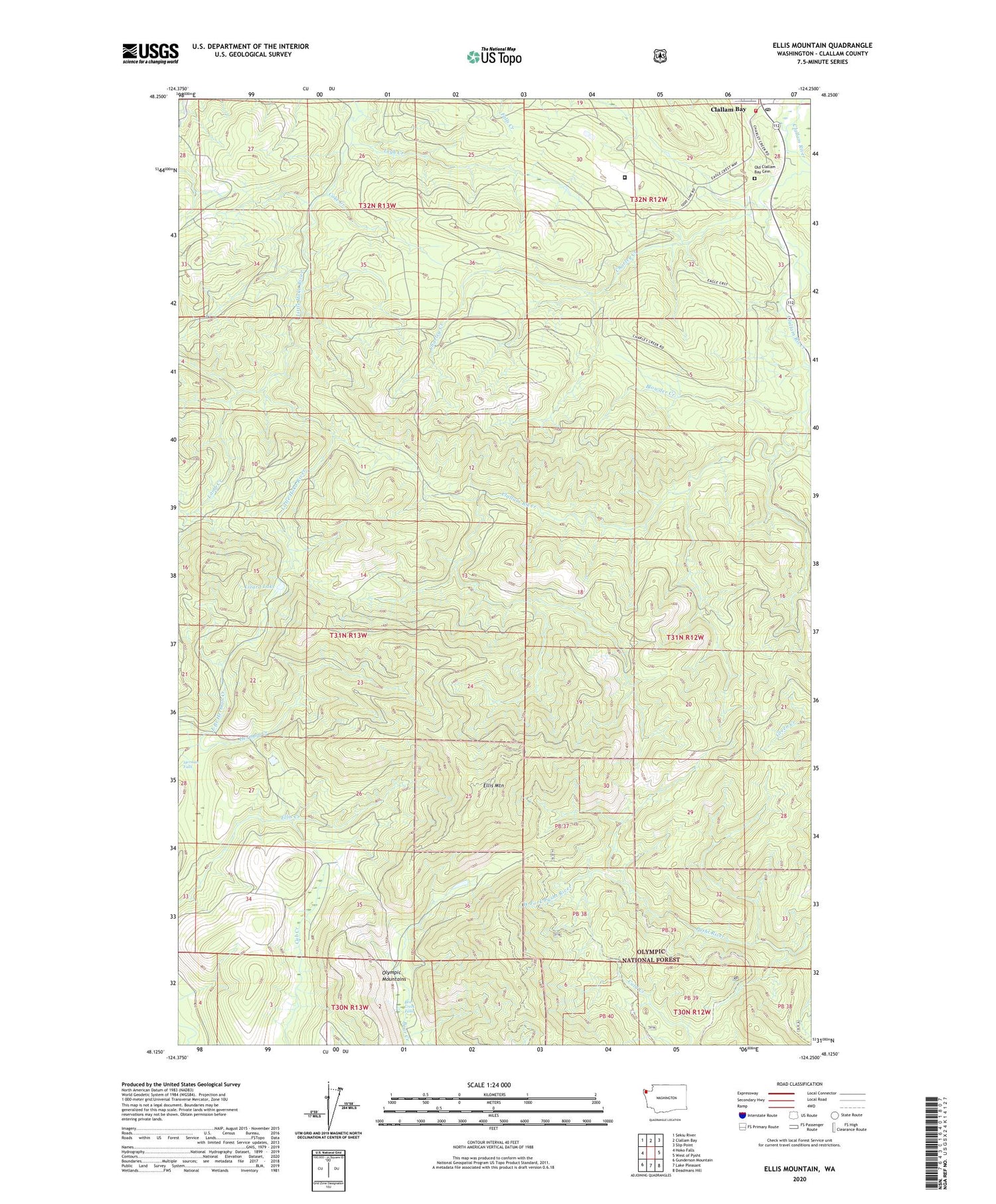
2020 topographic map quadrangle Ellis Mountain in the state of Washington. Scale: 1:24000. Based on the newly updated USGS 7.5' US Topo map series, this map is in the following counties: Clallam. The map contains contour data, water features, and other items you are used to seeing on USGS maps, but also has updated roads and other features. This is the next generation of topographic maps. Printed on high-quality waterproof paper with UV fade-resistant inks.
Quads adjacent to this one:
West: Hoko Falls
Northwest: Sekiu River
North: Clallam Bay
Northeast: Slip Point
East: West of Pysht
Southeast: Deadmans Hill
South: Lake Pleasant
Southwest: Gunderson Mountain
Contains the following named places: Bear Creek Falls, Blowder Creek, Charley Creek, Clallam Bay Correction Center Sewage Treatment Plant, Clallam Bay Corrections Center, Clallam Bay Post Office, Clallam County Fire District 5 Headquarters Station 1, Clallam Honor Camp, Clallam River Campground, Coke Creek, East Branch Herman Creek, Ellis Lookout, Ellis Mountain, Lamb Creek, Last Creek, Leyh Creek, Lizard Lake, Old Clallam Bay Cemetery, West Fork Pysht River


