MyTopo
Fields Spring Washington US Topo Map
Couldn't load pickup availability
Also explore the Fields Spring Forest Service Topo of this same quad for updated USFS data
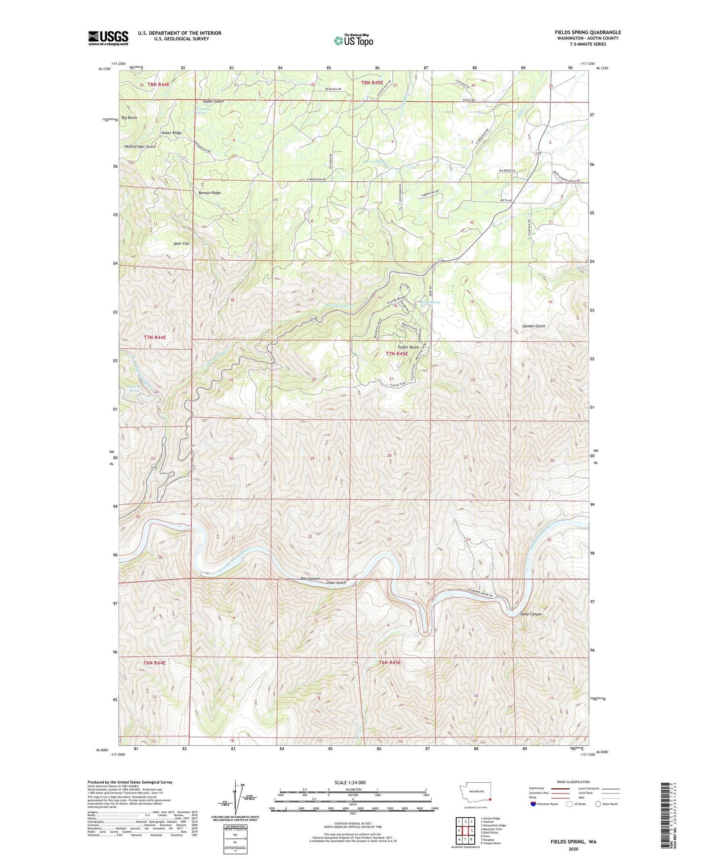
2023 topographic map quadrangle Fields Spring in the state of Washington. Scale: 1:24000. Based on the newly updated USGS 7.5' US Topo map series, this map is in the following counties: Asotin. The map contains contour data, water features, and other items you are used to seeing on USGS maps, but also has updated roads and other features. This is the next generation of topographic maps. Printed on high-quality waterproof paper with UV fade-resistant inks.
Quads adjacent to this one:
West: Mountain View
Northwest: Harlow Ridge
North: Anatone
Northeast: Weissenfels Ridge
East: Black Butte
Southeast: Teepee Butte
South: Paradise
Southwest: Flora
This map covers the same area as the classic USGS quad with code o46117a2.
Contains the following named places: Alder Gulch, Benson Ridge, Big Butte, Box Canyon, Deep Canyon, Deer Creek, Deer Flat, Fields Spring, Fields Spring State Park, Morengo Spring, Puffer Butte, Ray School, Tamarack Spring, West Branch Rattlesnake Creek, ZIP Code: 99401