MyTopo
Anatone Washington US Topo Map
Couldn't load pickup availability
Also explore the Anatone Forest Service Topo of this same quad for updated USFS data
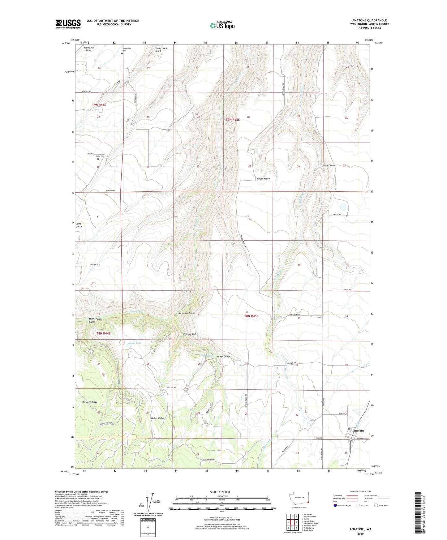
2023 topographic map quadrangle Anatone in the state of Washington. Scale: 1:24000. Based on the newly updated USGS 7.5' US Topo map series, this map is in the following counties: Asotin. The map contains contour data, water features, and other items you are used to seeing on USGS maps, but also has updated roads and other features. This is the next generation of topographic maps. Printed on high-quality waterproof paper with UV fade-resistant inks.
Quads adjacent to this one:
West: Harlow Ridge
Northwest: Potter Hill
North: Rockpile Creek
Northeast: Asotin
East: Weissenfels Ridge
Southeast: Black Butte
South: Fields Spring
Southwest: Mountain View
This map covers the same area as the classic USGS quad with code o46117b2.
Contains the following named places: Anatone, Anatone Census Designated Place, Anatone Post Office, Asotin County, Asotin Division, Bennett Ridge, Cloverland Cemetery, Hawks Run Airport, Hefflefinger Gulch, Huber Gulch, Huber Lake, Huber Ridge, Huber Spring, Lake Cemetery, Lake School, Meyer Ridge, Nims Gulch, Whitney Gulch, Wormell Gulch, ZIP Code: 99402