MyTopo
Foothills Washington US Topo Map
Couldn't load pickup availability
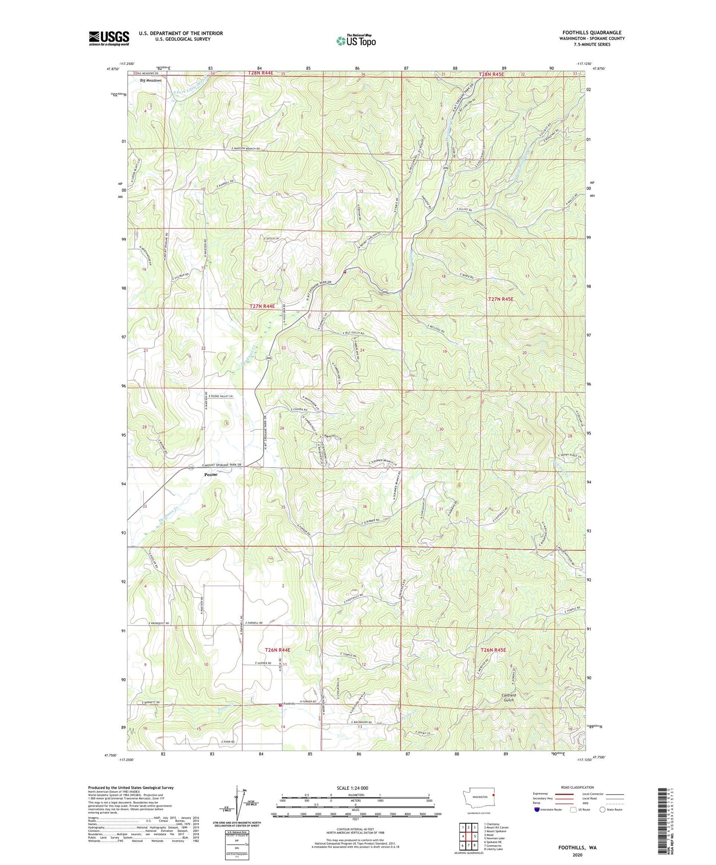
2023 topographic map quadrangle Foothills in the state of Washington. Scale: 1:24000. Based on the newly updated USGS 7.5' US Topo map series, this map is in the following counties: Spokane. The map contains contour data, water features, and other items you are used to seeing on USGS maps, but also has updated roads and other features. This is the next generation of topographic maps. Printed on high-quality waterproof paper with UV fade-resistant inks.
Quads adjacent to this one:
West: Mead
Northwest: Chattaroy
North: Mount Kit Carson
Northeast: Mount Spokane
East: Newman Lake
Southeast: Liberty Lake
South: Greenacres
Southwest: Spokane NE
This map covers the same area as the classic USGS quad with code o47117g2.
Contains the following named places: Foothills, Fothills, Green Bluff Substation, Mount Spokane Fire Station, Newman Creek, Peone, South Fork Deadman Creek, Spokane County Fire District 4 Station 48 Mount Spokane, Spokane County Fire District 9 Station 96, ZIP Code: 99021