MyTopo
Chattaroy Washington US Topo Map
Couldn't load pickup availability
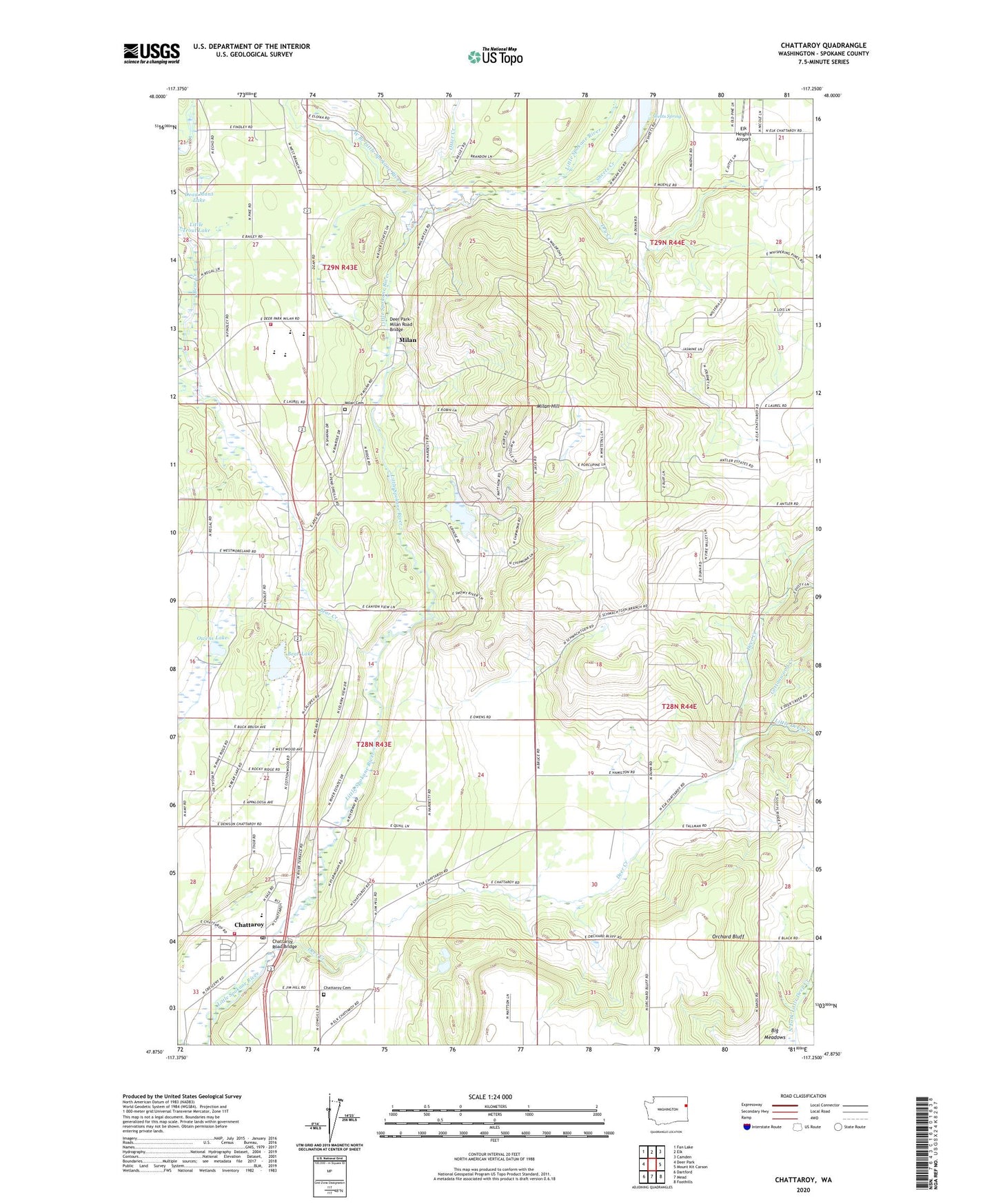
2023 topographic map quadrangle Chattaroy in the state of Washington. Scale: 1:24000. Based on the newly updated USGS 7.5' US Topo map series, this map is in the following counties: Spokane. The map contains contour data, water features, and other items you are used to seeing on USGS maps, but also has updated roads and other features. This is the next generation of topographic maps. Printed on high-quality waterproof paper with UV fade-resistant inks.
Quads adjacent to this one:
West: Deer Park
Northwest: Fan Lake
North: Elk
Northeast: Camden
East: Mount Kit Carson
Southeast: Foothills
South: Mead
Southwest: Dartford
This map covers the same area as the classic USGS quad with code o47117h3.
Contains the following named places: Bear Creek, Bear Lake, Chattaroy, Chattaroy Cemetery, Chattaroy Elementary School, Chattaroy Post Office, Chattaroy Road Bridge, Colbert Division, Cottonwood Creek, Dead Mans Lake, Deer Creek, Deer Park-Milan Road Bridge, Dragoon Creek, Dry Creek, Kehn Picnic Area, Lee's Airport, Little Deer Creek, Milan, Milan Cemetery, Milan Hill, Orchard Bluff, Otter Creek, Owens Lake, Reflection Lake, Reflection Lake South Dam, Riverside Elementary School, Riverside High School, Riverside Middle School, Sheets Creek, Sheets Spring, Spokane County Fire District 4 Station 42, Spokane County Fire District 4 Station 46 Riverside, West Branch Little Spokane River, ZIP Code: 99003