MyTopo
French Butte Washington US Topo Map
Couldn't load pickup availability
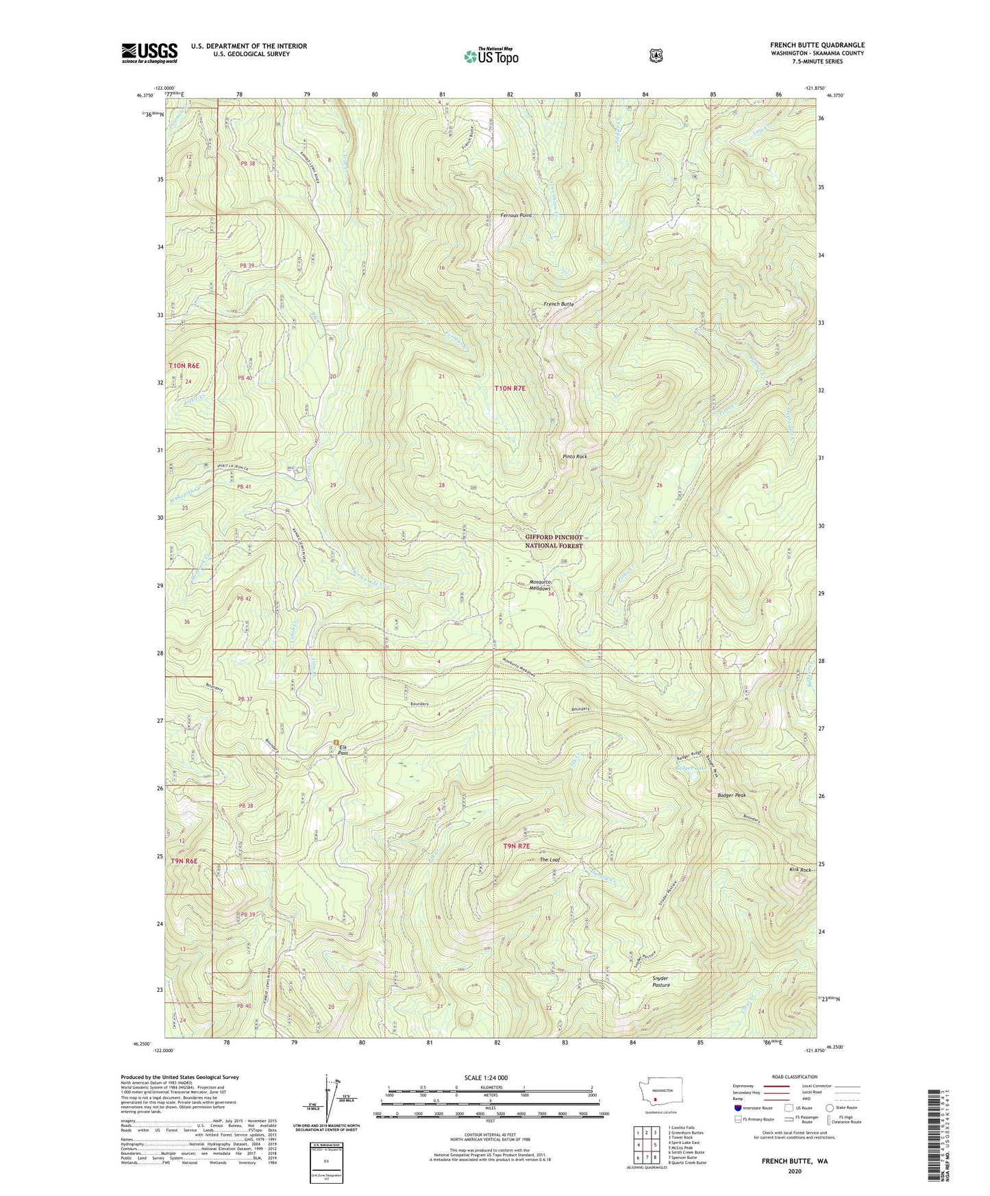
2020 topographic map quadrangle French Butte in the state of Washington. Scale: 1:24000. Based on the newly updated USGS 7.5' US Topo map series, this map is in the following counties: Skamania. The map contains contour data, water features, and other items you are used to seeing on USGS maps, but also has updated roads and other features. This is the next generation of topographic maps. Printed on high-quality waterproof paper with UV fade-resistant inks.
Quads adjacent to this one:
West: Spirit Lake East
Northwest: Cowlitz Falls
North: Greenhorn Buttes
Northeast: Tower Rock
East: McCoy Peak
Southeast: Quartz Creek Butte
South: Spencer Butte
Southwest: Smith Creek Butte
Contains the following named places: Badger Lake, Badger Peak, Badger Peak Lookout, Big Creek, Cabin Creek, Cato Creek, Elk Pass, Ferrous Creek, Ferrous Point, Ferrous Point Lookout, French Butte, Hemlock Creek, Hungry Creek, Iron Creek Guard Station, Kirk Rock, Little Creek, Mosquito Meadows, Pinto Rock, Pole Patch, Pole Patch Campground, Pumice Creek, Snyder Pasture, Stepladder Creek, The Loaf, Twelvemile Creek, Wakepish Creek