MyTopo
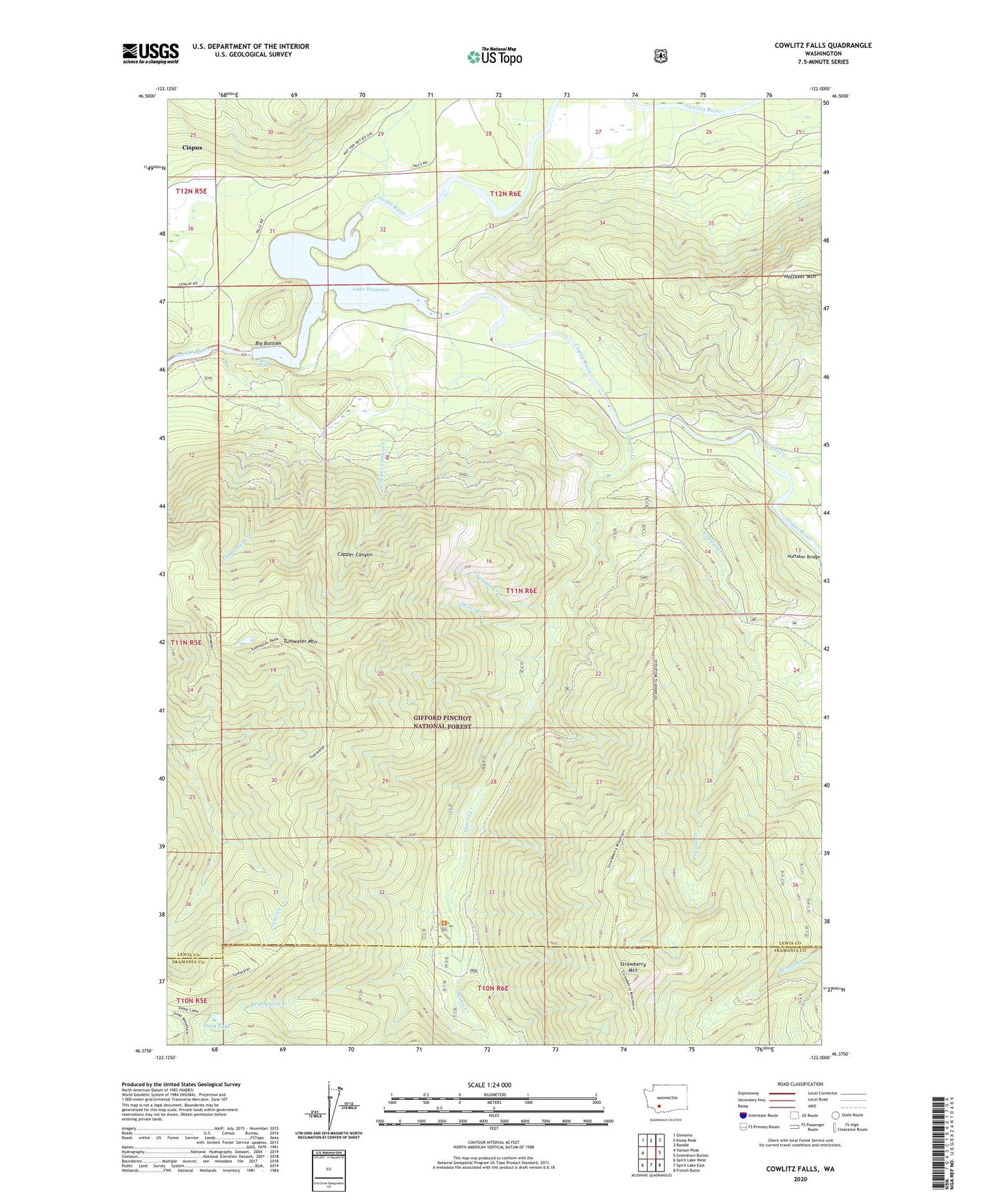
Cowlitz Falls Washington US Topo Map
Couldn't load pickup availability
Also explore the Cowlitz Falls Forest Service Topo of this same quad for updated USFS data
2023 topographic map quadrangle Cowlitz Falls in the state of Washington. Scale: 1:24000. Based on the newly updated USGS 7.5' US Topo map series, this map is in the following counties: Lewis, Skamania. The map contains contour data, water features, and other items you are used to seeing on USGS maps, but also has updated roads and other features. This is the next generation of topographic maps. Printed on high-quality waterproof paper with UV fade-resistant inks.
Quads adjacent to this one:
West: Vanson Peak
Northwest: Glenoma
North: Kiona Peak
Northeast: Randle
East: Greenhorn Buttes
Southeast: French Butte
South: Spirit Lake East
Southwest: Spirit Lake West
This map covers the same area as the classic USGS quad with code o46122d1.
Contains the following named places: Big Bottom, Cispus, Cispus River, Copper Canyon, Copper Canyon Creek, Cowlitz Falls, Crystal Creek, Deep Lake, Huffaker Mountain, Kelly Ranch, Lake Scanewa, Moses Creek, Quartz Creek, Quartz Creek Big Trees Campground, Red Spring Creek, Strawberry Mountain, Sulphur Creek, Tumwater Creek, Tumwater Mountain, Woods Creek