MyTopo
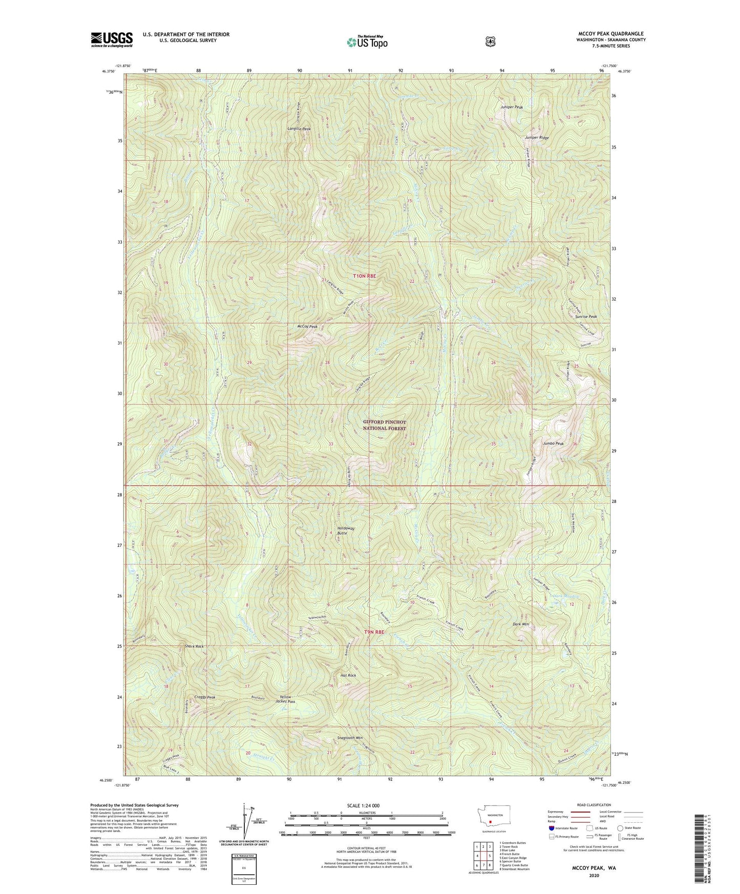
McCoy Peak Washington US Topo Map
Couldn't load pickup availability
Also explore the McCoy Peak Forest Service Topo of this same quad for updated USFS data
2023 topographic map quadrangle McCoy Peak in the state of Washington. Scale: 1:24000. Based on the newly updated USGS 7.5' US Topo map series, this map is in the following counties: Skamania. The map contains contour data, water features, and other items you are used to seeing on USGS maps, but also has updated roads and other features. This is the next generation of topographic maps. Printed on high-quality waterproof paper with UV fade-resistant inks.
Quads adjacent to this one:
West: French Butte
Northwest: Greenhorn Buttes
North: Tower Rock
Northeast: Blue Lake
East: East Canyon Ridge
Southeast: Steamboat Mountain
South: Quartz Creek Butte
Southwest: Spencer Butte
This map covers the same area as the classic USGS quad with code o46121c7.
Contains the following named places: Badger Creek, Bear Creek, Camp Creek, Craggy Peak, Dark Meadow, Dark Mountain, French Creek, French Creek Trail, Granite Creek, Hat Rock, Holdaway Butte, Jumbo Creek, Jumbo Peak, Juniper Peak, Juniper Ridge, Langille Creek, Langille Peak, McCoy Peak, McCoy Peak Lokout, Pinto Creek, Scamp Creek, Shark Rock, Snagtooth Mountain, Sunrise Creek, Sunrise Peak, Sunrise Peak Lookout, Veta Creek, Yellow Jacket Pass