MyTopo
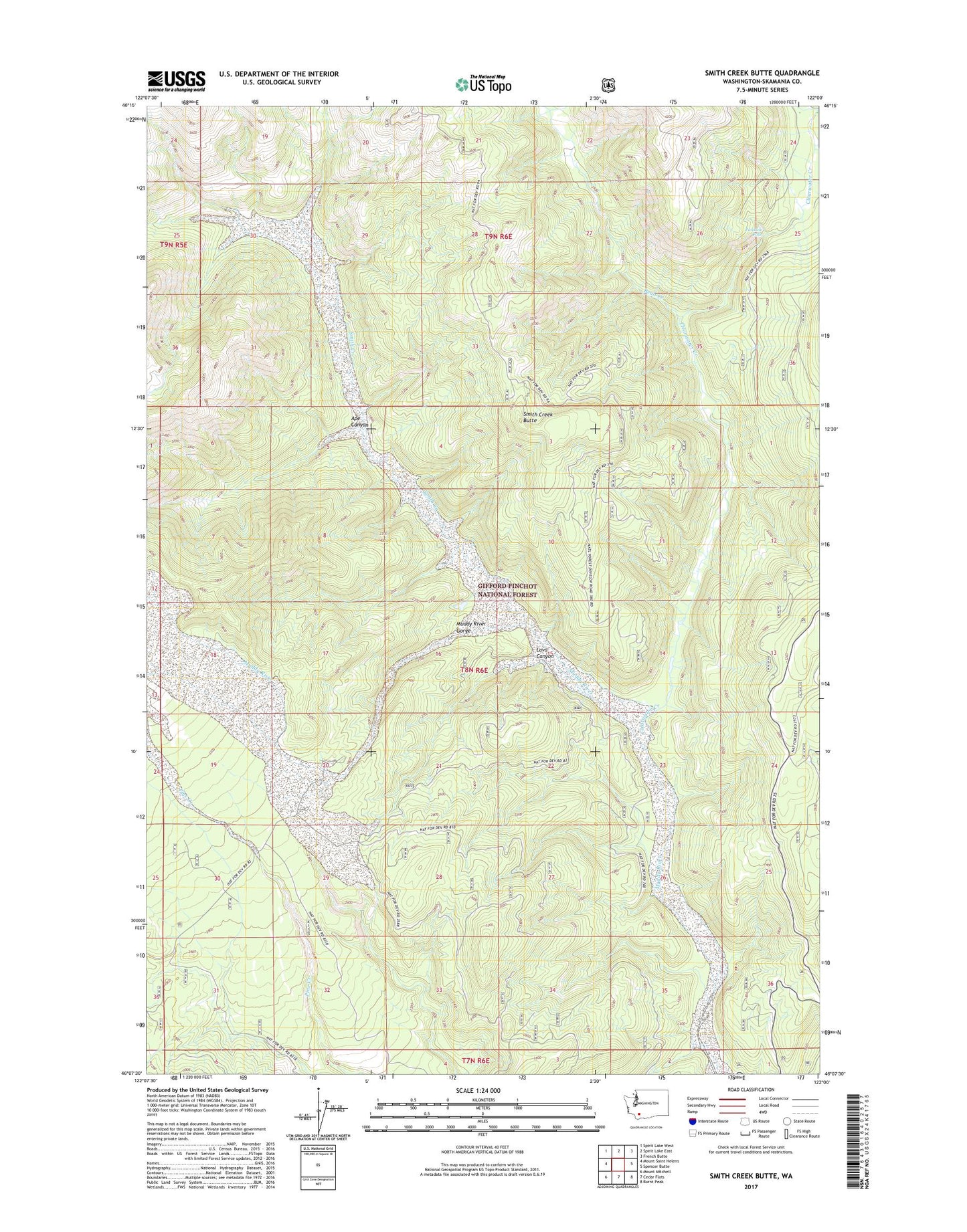
Smith Creek Butte Washington US Topo Map
Couldn't load pickup availability
Also explore the Smith Creek Butte Forest Service Topo of this same quad for updated USFS data
2023 topographic map quadrangle Smith Creek Butte in the state of Washington. Scale: 1:24000. Based on the newly updated USGS 7.5' US Topo map series, this map is in the following counties: Skamania. The map contains contour data, water features, and other items you are used to seeing on USGS maps, but also has updated roads and other features. This is the next generation of topographic maps. Printed on high-quality waterproof paper with UV fade-resistant inks.
Quads adjacent to this one:
West: Mount Saint Helens
Northwest: Spirit Lake West
North: Spirit Lake East
Northeast: French Butte
East: Spencer Butte
Southeast: Burnt Peak
South: Cedar Flats
Southwest: Mount Mitchell
This map covers the same area as the classic USGS quad with code o46122b1.
Contains the following named places: Ape Canyon, Bean Creek, Bean Creek Trail, Bear Lake, Clearwater Creek, Crane Lake, Hoo Hoo Lake, Jackpine Shelter, Lahar Viewpoint, Lava Canyon, Muddy River Gorge, Muddy River Trail, Paradise Falls, Smith Creek, Smith Creek Butte, Smith Creek Butte Lookout, Smith Creek Butte Trail, Smith Creek Trail