MyTopo
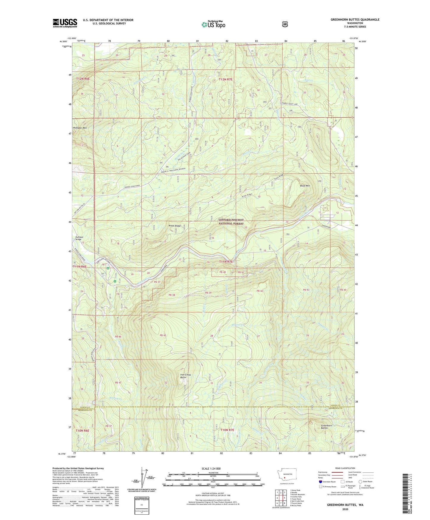
Greenhorn Buttes Washington US Topo Map
Couldn't load pickup availability
Also explore the Greenhorn Buttes Forest Service Topo of this same quad for updated USFS data
2023 topographic map quadrangle Greenhorn Buttes in the state of Washington. Scale: 1:24000. Based on the newly updated USGS 7.5' US Topo map series, this map is in the following counties: Lewis, Skamania. The map contains contour data, water features, and other items you are used to seeing on USGS maps, but also has updated roads and other features. This is the next generation of topographic maps. Printed on high-quality waterproof paper with UV fade-resistant inks.
Quads adjacent to this one:
West: Cowlitz Falls
Northwest: Kiona Peak
North: Randle
Northeast: Purcell Mountain
East: Tower Rock
Southeast: McCoy Peak
South: French Butte
Southwest: Spirit Lake East
This map covers the same area as the classic USGS quad with code o46121d8.
Contains the following named places: 1918 Creek, Ames Creek, Benham Creek, Bluff Mountain, Falls Creek, Fourmile Creek, Greenhorn Buttes, Greenhorn Creek, Huffaker Bridge, Iron Creek, Iron Creek Butte, Iron Creek Campground, Iron Creek Information Center, Jefferson Creek, Kraus Ridge, Monroe Creek, Nash Creek, Soldier Creek, Squire Creek, Stump Creek, Trapper Creek