MyTopo
Gee Point Washington US Topo Map
Couldn't load pickup availability
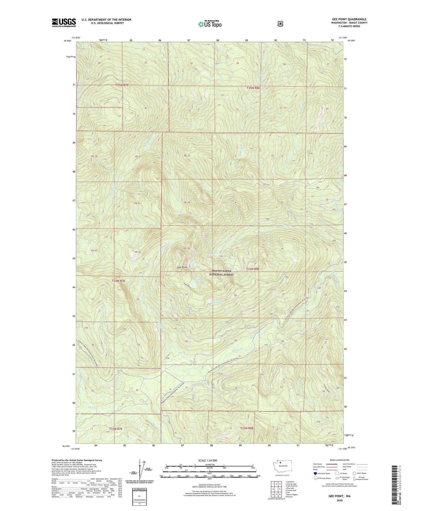
2020 topographic map quadrangle Gee Point in the state of Washington. Scale: 1:24000. Based on the newly updated USGS 7.5' US Topo map series, this map is in the following counties: Skagit. The map contains contour data, water features, and other items you are used to seeing on USGS maps, but also has updated roads and other features. This is the next generation of topographic maps. Printed on high-quality waterproof paper with UV fade-resistant inks.
Quads adjacent to this one:
West: Day Lake
Northwest: Hamilton
North: Grandy Lake
Northeast: Lake Shannon
East: Finney Peak
Southeast: Fortson
South: Mount Higgins
Southwest: Oso
Contains the following named places: Chute Creek, Clendenen Creek, DeForest Creek, Finney Creek Trail, Finney Peak Trail, Gee Point, Gee Point Lake, Gee Point Lookout, Gee Point Trail, Leonards Ridge, Little Deer Creek, Little Gee Lake, Skagit County