MyTopo
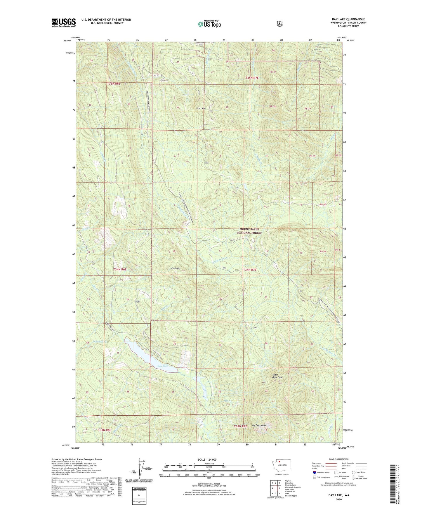
Day Lake Washington US Topo Map
Couldn't load pickup availability
Also explore the Day Lake Forest Service Topo of this same quad for updated USFS data
2023 topographic map quadrangle Day Lake in the state of Washington. Scale: 1:24000. Based on the newly updated USGS 7.5' US Topo map series, this map is in the following counties: Skagit. The map contains contour data, water features, and other items you are used to seeing on USGS maps, but also has updated roads and other features. This is the next generation of topographic maps. Printed on high-quality waterproof paper with UV fade-resistant inks.
Quads adjacent to this one:
West: Haystack Mountain
Northwest: Lyman
North: Hamilton
Northeast: Grandy Lake
East: Gee Point
Southeast: Mount Higgins
South: Oso
Southwest: Stimson Hill
This map covers the same area as the classic USGS quad with code o48121d8.
Contains the following named places: Big Deer Peak, Campbell Creek, Carry Creek, Coal Mountain, Day Lake, Fish Creek, Iron Mountain, Lake Cavanaugh Division, Little Deer Peak