MyTopo
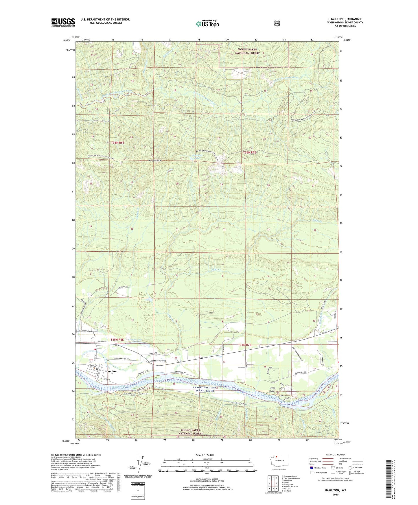
Hamilton Washington US Topo Map
Couldn't load pickup availability
Also explore the Hamilton Forest Service Topo of this same quad for updated USFS data
2023 topographic map quadrangle Hamilton in the state of Washington. Scale: 1:24000. Based on the newly updated USGS 7.5' US Topo map series, this map is in the following counties: Skagit. The map contains contour data, water features, and other items you are used to seeing on USGS maps, but also has updated roads and other features. This is the next generation of topographic maps. Printed on high-quality waterproof paper with UV fade-resistant inks.
Quads adjacent to this one:
West: Lyman
Northwest: Cavanaugh Creek
North: Twin Sisters Mountain
Northeast: Baker Pass
East: Grandy Lake
Southeast: Gee Point
South: Day Lake
Southwest: Haystack Mountain
This map covers the same area as the classic USGS quad with code o48121e8.
Contains the following named places: Alder Creek, Birdsview, Birdsview Siding, Boyd Creek, Careys Lake, Cumberland Creek, Grandy Creek, Hamilton, Hamilton Fire Department, Hamilton First Baptist Church, Hamilton Post Office, Howard Creek, Josephine Lakes, Lyman-Hamilton Division, Marietta Creek, McGinnis Creek, Mill Creek, Mount Josephine, Mount Josephine Lookout, O'Toole Creek, Skagit County Fire District 10 Birdsview Volunteer Fire Department, Sylvester Creek, Town of Hamilton, Twin Sisters Pit Number Two, Twin Sisters Pit Number Two Dam, ZIP Code: 98255