MyTopo
Granger Washington US Topo Map
Couldn't load pickup availability
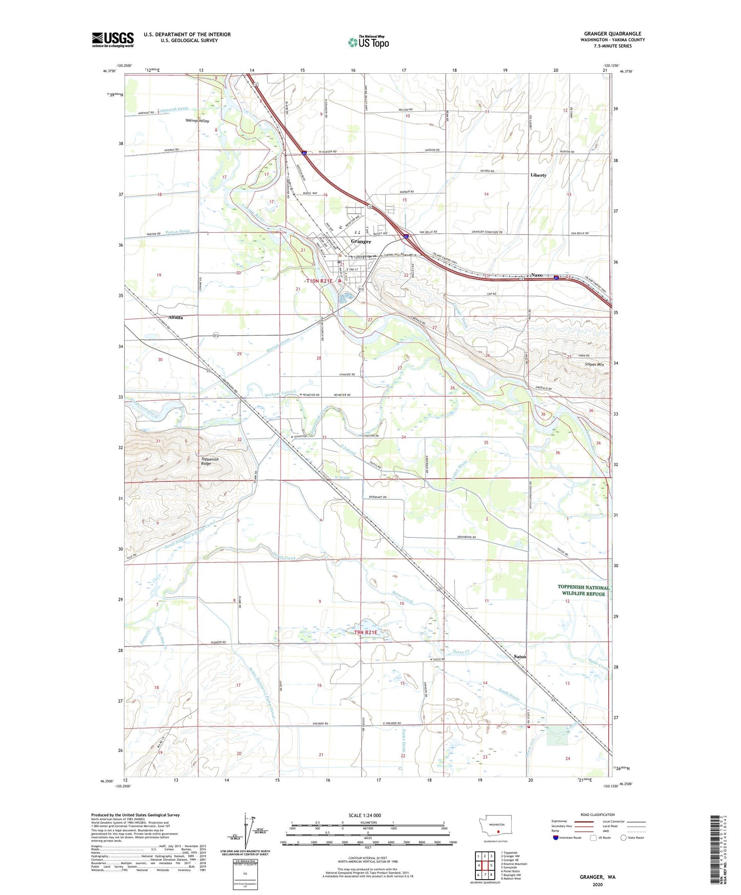
2023 topographic map quadrangle Granger in the state of Washington. Scale: 1:24000. Based on the newly updated USGS 7.5' US Topo map series, this map is in the following counties: Yakima. The map contains contour data, water features, and other items you are used to seeing on USGS maps, but also has updated roads and other features. This is the next generation of topographic maps. Printed on high-quality waterproof paper with UV fade-resistant inks.
Quads adjacent to this one:
Northwest: Toppenish
North: Granger NW
Northeast: Granger NE
East: Sunnyside
Southeast: Mabton West
South: Bluelight NW
Southwest: Poisel Butte
This map covers the same area as the classic USGS quad with code o46120c2.
Contains the following named places: Alfalfa, City of Granger, Coulee Drain, Crewport, Durham Lateral, East Lateral, Foster Drain, Granger, Granger Drain, Granger Farm Labor Camp, Granger High School, Granger Post Office, Hisey Park, Indian Shaker Church, Liberty, Mule Dry Creek, Nass, North Barnhart Road Draw, North Drain, Parton Drain, Roosevelt Grade School, Satus, Satus Longhouse, Satus Number 2 Pumping Station, South Drain, Toppenish Creek, Yakima County Fire District 5 Station 11 Granger, Yakima County Fire District 5 Station 16 Satus, ZIP Code: 98932