MyTopo
Sunnyside Washington US Topo Map
Couldn't load pickup availability
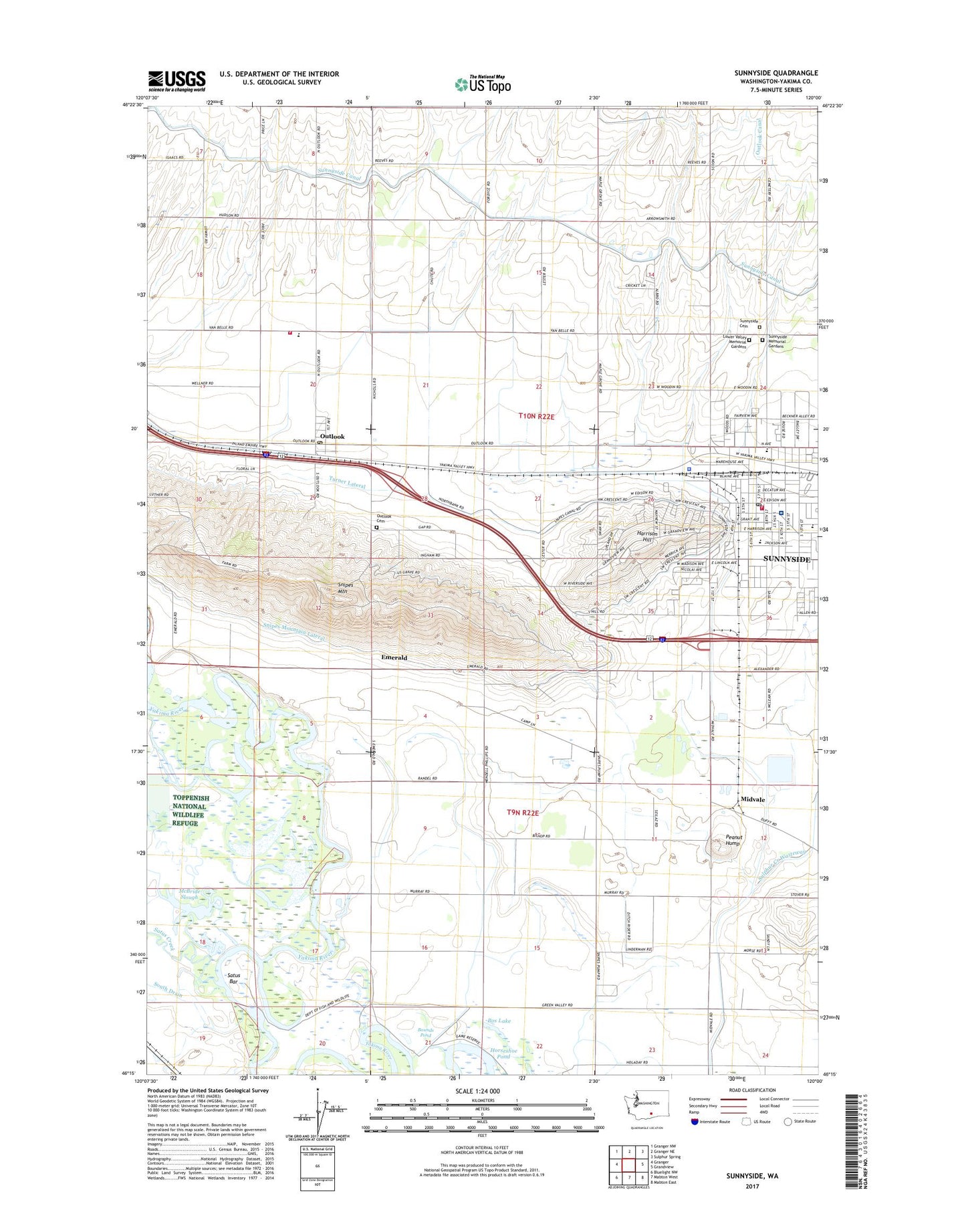
2023 topographic map quadrangle Sunnyside in the state of Washington. Scale: 1:24000. Based on the newly updated USGS 7.5' US Topo map series, this map is in the following counties: Yakima. The map contains contour data, water features, and other items you are used to seeing on USGS maps, but also has updated roads and other features. This is the next generation of topographic maps. Printed on high-quality waterproof paper with UV fade-resistant inks.
Quads adjacent to this one:
West: Granger
Northwest: Granger NW
North: Granger NE
Northeast: Sulphur Spring
East: Grandview
Southeast: Mabton East
South: Mabton West
Southwest: Bluelight NW
This map covers the same area as the classic USGS quad with code o46120c1.
Contains the following named places: Bos Lake, Bounds Pond, Chief Kamiakin School, City of Sunnyside, Emerald, Harrison Hill, Horseshoe Pond, KREW-AM (Sunnyside), KREW-FM (Sunnyside), Lincoln School, Lower Valley Memorial Gardens, McBride Slough, Midvale, Old Sunnyside Cemetery, Outlook, Outlook Canal, Outlook Cemetery, Outlook Census Designated Place, Outlook Elementary School, Outlook Post Office, Peanut Hump, Saint Josephs School, Satus Bar, Satus Creek, Servu, Snipes Mountain, Snipes Mountain Lateral, Sulphur Creek Wasteway, Sunnyside, Sunnyside Christian School, Sunnyside Community Hospital, Sunnyside Fire Department and Emergency Medical Services, Sunnyside Memorial Gardens, Sunnyside Museum, Sunnyside Police Department, Sunnyside Post Office, Sunnyside Seventh Day Adventist School, Turner Lateral, Washington Elementary School, Wendell Phillips School, Yakima County Fire District 5 Station 12 Outlook, Yakima County Fire District 5 Station 13 Sunnyside