MyTopo
Granger NW Washington US Topo Map
Couldn't load pickup availability
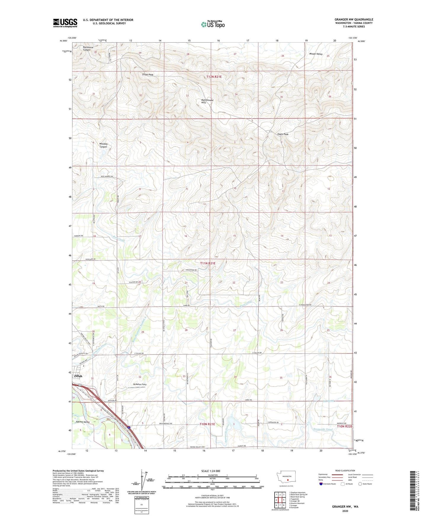
2023 topographic map quadrangle Granger NW in the state of Washington. Scale: 1:24000. Based on the newly updated USGS 7.5' US Topo map series, this map is in the following counties: Yakima. The map contains contour data, water features, and other items you are used to seeing on USGS maps, but also has updated roads and other features. This is the next generation of topographic maps. Printed on high-quality waterproof paper with UV fade-resistant inks.
Quads adjacent to this one:
West: Toppenish
Northwest: Elephant Mountain
North: Black Rock Spring SW
Northeast: Black Rock Spring
East: Granger NE
Southeast: Sunnyside
South: Granger
This map covers the same area as the classic USGS quad with code o46120d2.
Contains the following named places: Bunger Dam, Eagle Peak, McMahon Field, Punkin Center, Roza Wasteway Number 4, West Lateral, Whiskey Canyon, Zillah High School, Zillah Peak, ZIP Code: 98953