MyTopo
Grays River Washington US Topo Map
Couldn't load pickup availability
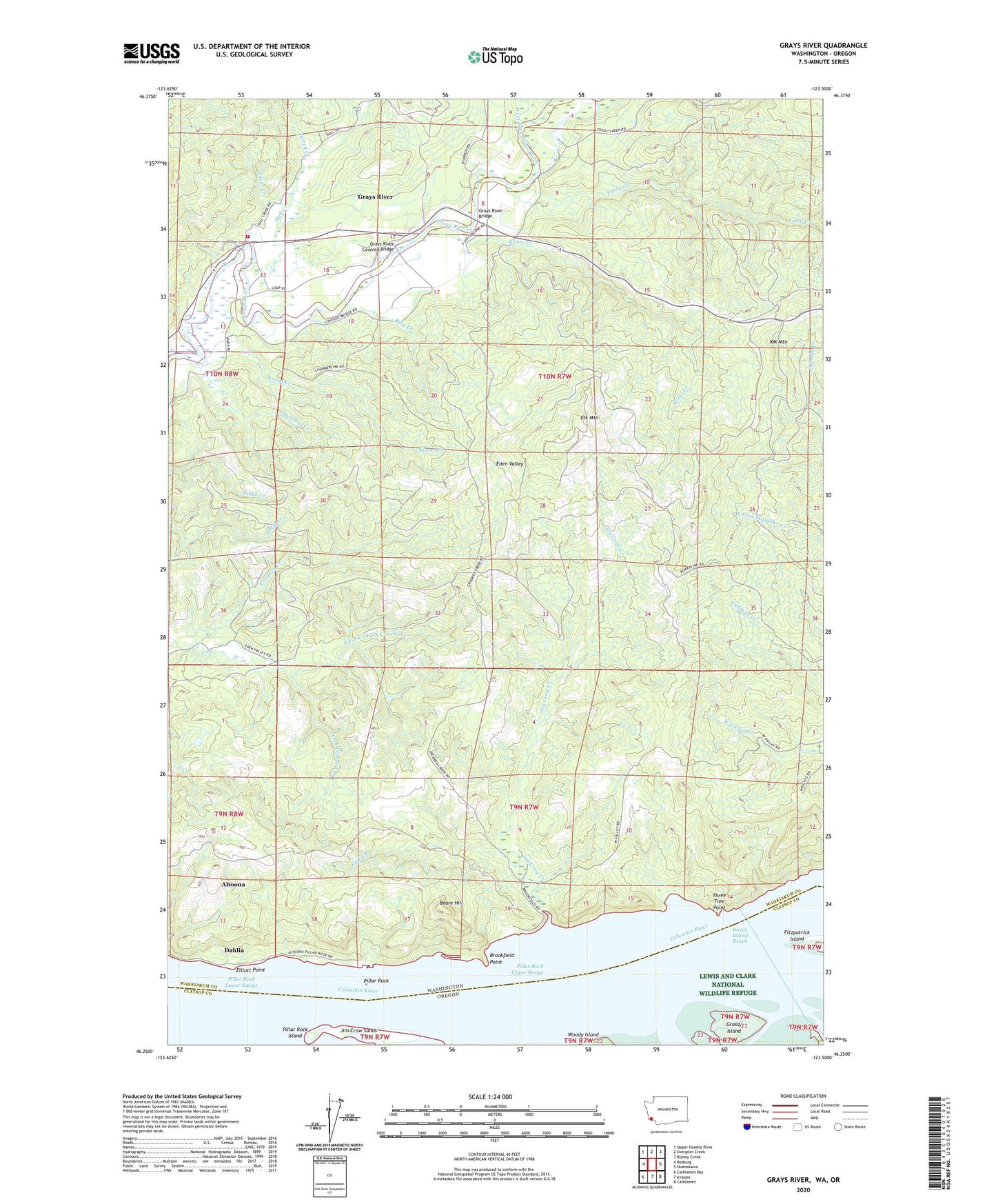
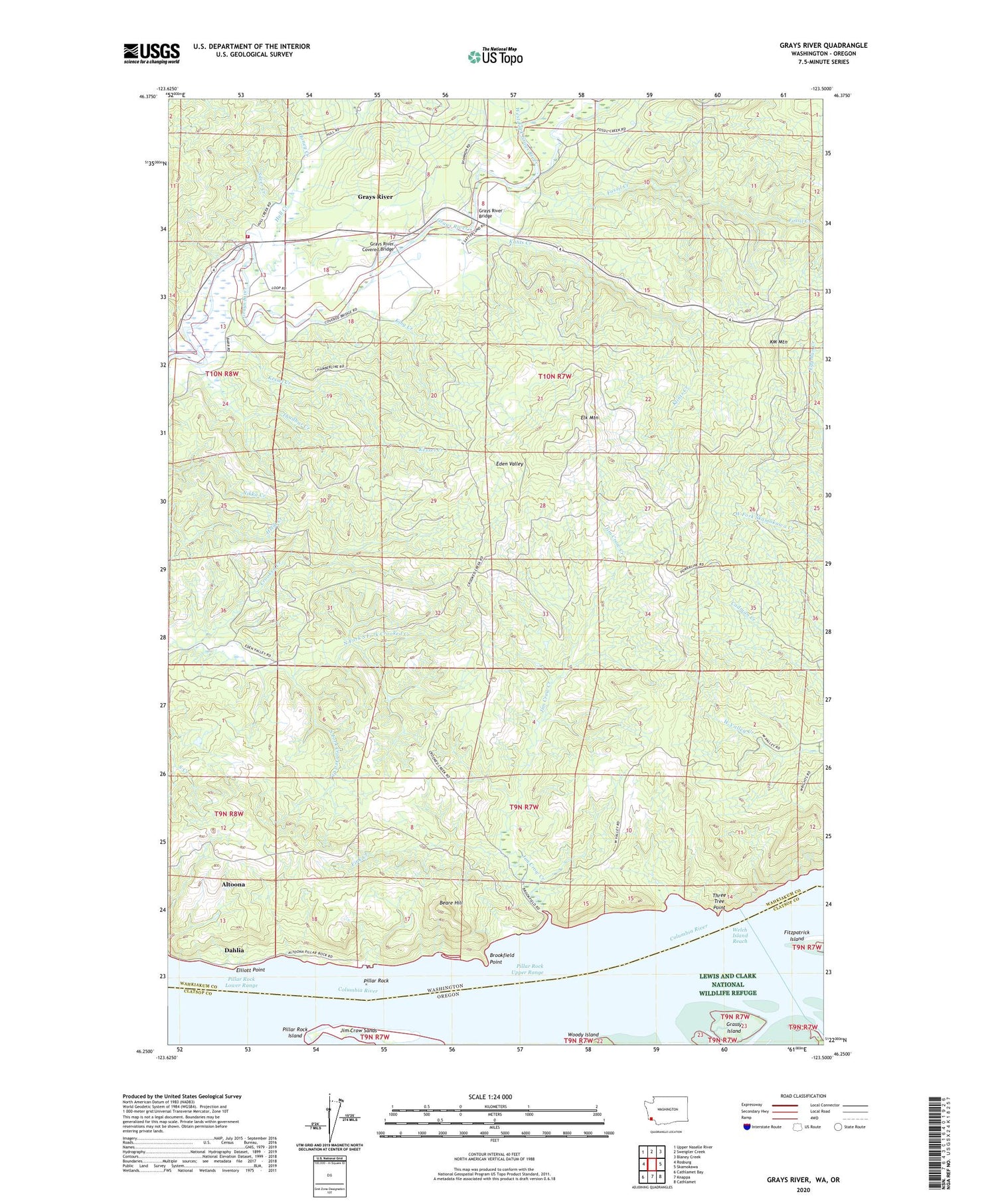
2020 topographic map quadrangle Grays River in the states of Washington, Oregon. Scale: 1:24000. Based on the newly updated USGS 7.5' US Topo map series, this map is in the following counties: Wahkiakum, Clatsop. The map contains contour data, water features, and other items you are used to seeing on USGS maps, but also has updated roads and other features. This is the next generation of topographic maps. Printed on high-quality waterproof paper with UV fade-resistant inks.
Quads adjacent to this one:
West: Rosburg
Northwest: Upper Naselle River
North: Sweigiler Creek
Northeast: Blaney Creek
East: Skamokawa
Southeast: Cathlamet
South: Knappa
Southwest: Cathlamet Bay
Contains the following named places: Altoona Census Designated Place, Beare Hill, Brookfield, Brookfield Point, Dahlia, Elk Mountain, Elliot School, Elliott Point, Fall Creek, Fink Creek, Fossil Creek, Grassy Island, Grays River, Grays River Bridge, Grays River Census Designated Place, Grays River Covered Bridge, Grays River Division, Grays River Methodist Church, Harlows Creek, Honey Creek, Hull Creek, Kessel Creek, King Creek, Klints Creek, KM Mountain, North Fork South Fork Crooked Creek, Pillar Rock, Pillar Rock Cannery, Pillar Rock Dam Number One, Pillar Rock Dam Number Two, Pillar Rock Island, Pillar Rock Lower Range, Pillar Rock Upper Range, Silver Creek, South Fork Crooked Creek, Thadbar Creek, Three Tree Point, Wahkiakum Fire District 3 Grays River Fire Department, Welch Island Reach, West Fork Grays River, ZIP Code: 98643