MyTopo
Skamokawa Washington US Topo Map
Couldn't load pickup availability
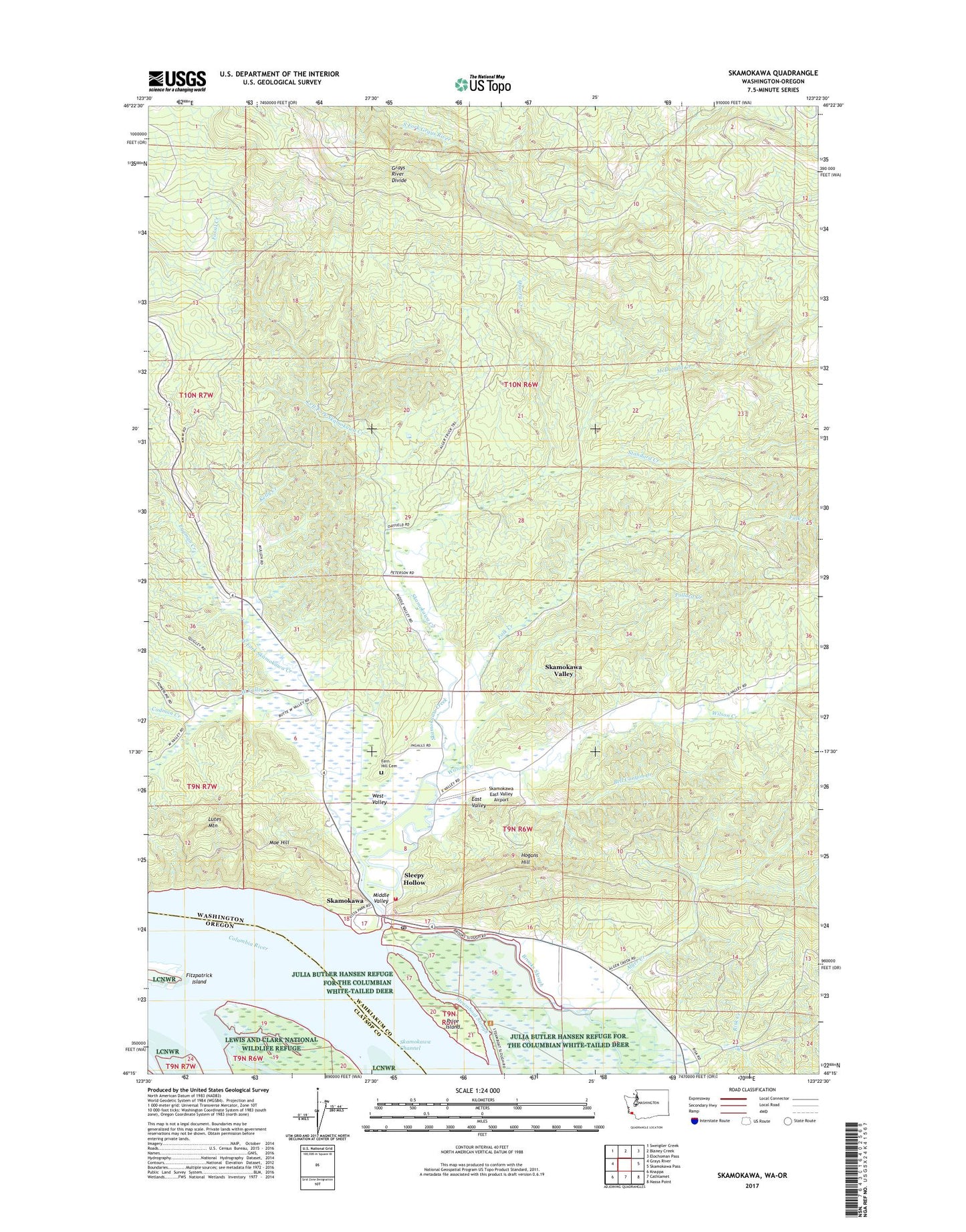
2023 topographic map quadrangle Skamokawa in the states of Washington, Oregon. Scale: 1:24000. Based on the newly updated USGS 7.5' US Topo map series, this map is in the following counties: Wahkiakum, Clatsop. The map contains contour data, water features, and other items you are used to seeing on USGS maps, but also has updated roads and other features. This is the next generation of topographic maps. Printed on high-quality waterproof paper with UV fade-resistant inks.
Quads adjacent to this one:
West: Grays River
Northwest: Sweigiler Creek
North: Blaney Creek
Northeast: Elochoman Pass
East: Skamokawa Pass
Southeast: Nassa Point
South: Cathlamet
Southwest: Knappa
This map covers the same area as the classic USGS quad with code o46123c4.
Contains the following named places: Alger Creek, Alger Truck Trail, Bell Canyon Creek, Brooks Slough, Cadman Creek, East Valley, Eggman Creek, Falk Creek, Fern Hill Cemetery, Fitzpatrick Island, Hogans Hill, Kelly Creek, Left Fork Skamokawa Creek, Lutes Mountain, McDonald Creek, Middle Valley, Moe Hill, Pollard Creek, Price Island, Quarry Creek, Redmen Hall and River Life Interpretive Center, Risk Creek, Skamokawa, Skamokawa Channel, Skamokawa Channel Range, Skamokawa Creek, Skamokawa East Valley Airport, Skamokawa Post Office, Skamokawa United Methodist Church, Skamokawa Valley Census Designated Place, Skamokawa Vista Park, Sleepy Hollow, Standard Creek, Steamboat Slough, Wahkiakum County, Wahkiakum County Fairgrounds, Wahkiakum Fire District 2 Skamokawa Fire Department, West Fork Skamokawa Creek, West Valley, West Valley Creek, Wilson Creek, ZIP Code: 98647