MyTopo
Greenwater Washington US Topo Map
Couldn't load pickup availability
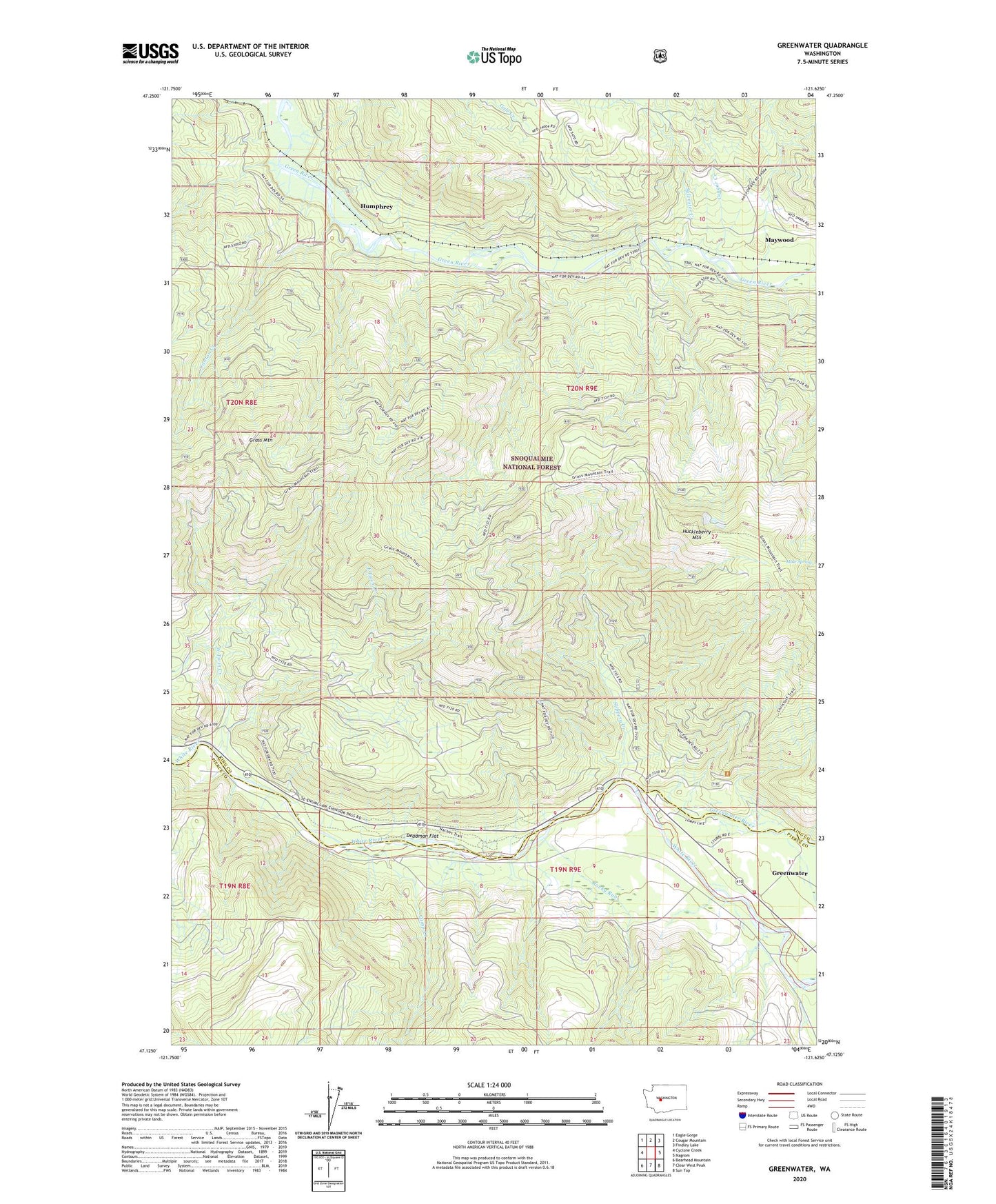
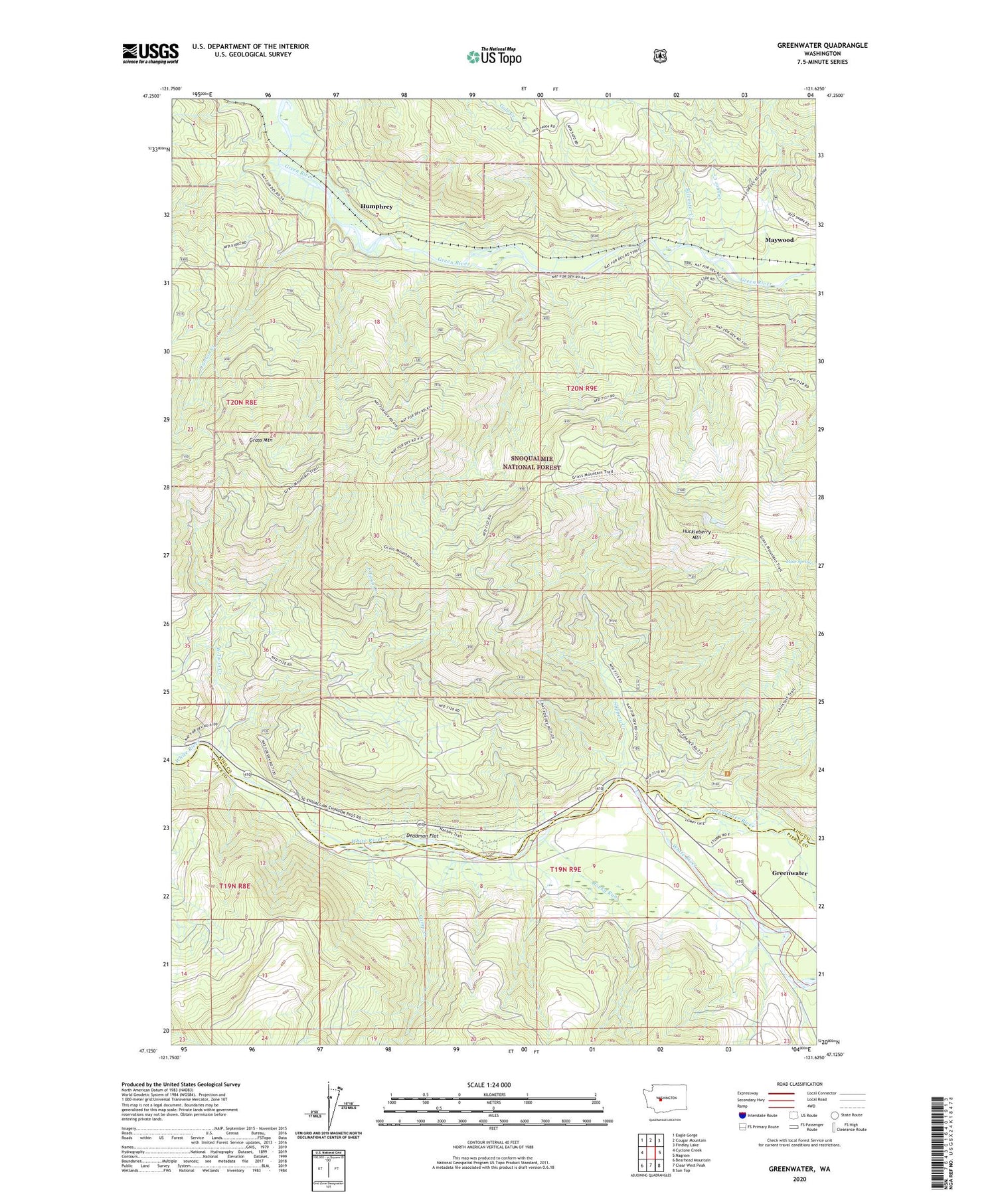
2020 topographic map quadrangle Greenwater in the state of Washington. Scale: 1:24000. Based on the newly updated USGS 7.5' US Topo map series, this map is in the following counties: King, Pierce. The map contains contour data, water features, and other items you are used to seeing on USGS maps, but also has updated roads and other features. This is the next generation of topographic maps. Printed on high-quality waterproof paper with UV fade-resistant inks.
Quads adjacent to this one:
West: Cyclone Creek
Northwest: Eagle Gorge
North: Cougar Mountain
Northeast: Findley Lake
East: Nagrom
Southeast: Sun Top
South: Clear West Peak
Southwest: Bearhead Mountain
Contains the following named places: Bone Lake Trail, Camp Creek, Canton Creek, Christoff Trail, Cougar Creek, Deadman Flat, East Twin Creek, Federation Forest State Park, Greenwater, Greenwater Census Designated Place, Greenwater River, Humphrey, Humphrey Lookout, Maywood, Mule Spring, Pierce County Fire District 26 Greenwater Station, Rocky Run, Slippery Creek, Sylvester Creek, Twin Creeks Guard Station, West Twin Creek