MyTopo
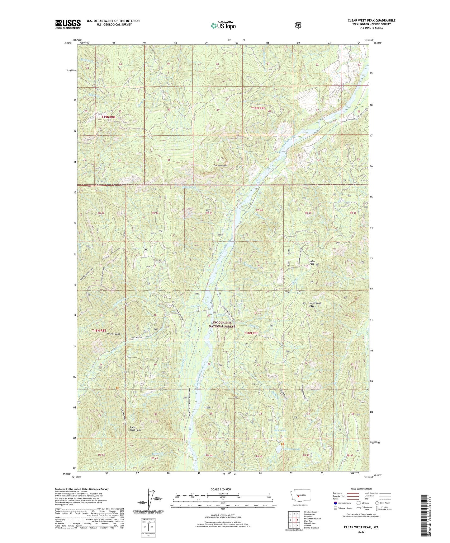
Clear West Peak Washington US Topo Map
Couldn't load pickup availability
Also explore the Clear West Peak Forest Service Topo of this same quad for updated USFS data
2023 topographic map quadrangle Clear West Peak in the state of Washington. Scale: 1:24000. Based on the newly updated USGS 7.5' US Topo map series, this map is in the following counties: Pierce. The map contains contour data, water features, and other items you are used to seeing on USGS maps, but also has updated roads and other features. This is the next generation of topographic maps. Printed on high-quality waterproof paper with UV fade-resistant inks.
Quads adjacent to this one:
West: Bearhead Mountain
Northwest: Cyclone Creek
North: Greenwater
Northeast: Nagrom
East: Sun Top
Southeast: White River Park
South: Sunrise
Southwest: Mowich Lake
This map covers the same area as the classic USGS quad with code o47121a6.
Contains the following named places: Clear West Peak, Clear West Peak Lookout, Eleanor Creek, Flip-O-Way Trail, Haller Pass, Hank Creek, Hazzard Creek, Jim Creek, Joe Creek, Lonesome Lake, Mule Creek, Mule Lake, Nosedive Creek, Pigeon Creek, Pinochle Creek, The Palisades, Thirsty Creek, Three Peaks, Viola Creek, Wrong Creek