MyTopo
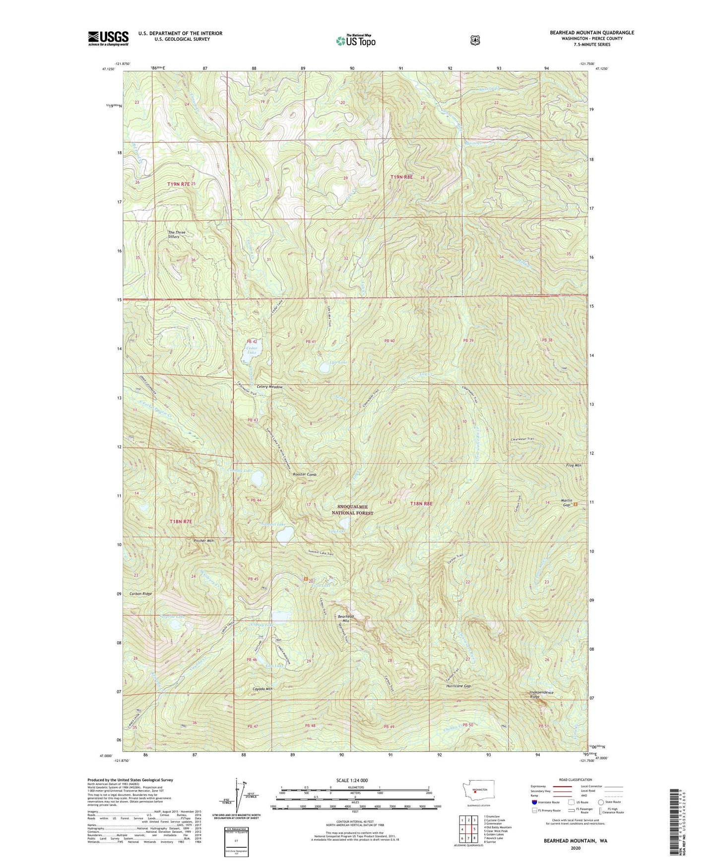
Bearhead Mountain Washington US Topo Map
Couldn't load pickup availability
Also explore the Bearhead Mountain Forest Service Topo of this same quad for updated USFS data
2023 topographic map quadrangle Bearhead Mountain in the state of Washington. Scale: 1:24000. Based on the newly updated USGS 7.5' US Topo map series, this map is in the following counties: Pierce. The map contains contour data, water features, and other items you are used to seeing on USGS maps, but also has updated roads and other features. This is the next generation of topographic maps. Printed on high-quality waterproof paper with UV fade-resistant inks.
Quads adjacent to this one:
West: Old Baldy Mountain
Northwest: Enumclaw
North: Cyclone Creek
Northeast: Greenwater
East: Clear West Peak
Southeast: Sunrise
South: Mowich Lake
Southwest: Golden Lakes
This map covers the same area as the classic USGS quad with code o47121a7.
Contains the following named places: Bearhead Mountain, Byron Creek, Carbon Trail, Cayada Mountain, Cedar Lake, Celery Meadow, Clearwater Trail, Clearwater Wilderness, Clipper Mine, Coplay Lake, Copper King Mine, Coundly Lake, Double Camp Shelter, Dry Camp, East Lake, Falls Creek, Frog Mountain, Hurricane Gap, Kennedy Creek, Lily Creek, Lily Lake, Lyle Creek, Lyle Lake, Martin Gap, McGilvery Creek, Milky Creek, Mineral Creek, Pitcher Mountain, Queen Bee Mine, Rooster Comb, Summit Lake, Summit Lake Trail, Surprise Lake, Test Creek, The Three Sisters, Twin Lake, W-E Camp Shelter, ZIP Code: 98323