MyTopo
Hansville Washington US Topo Map
Couldn't load pickup availability
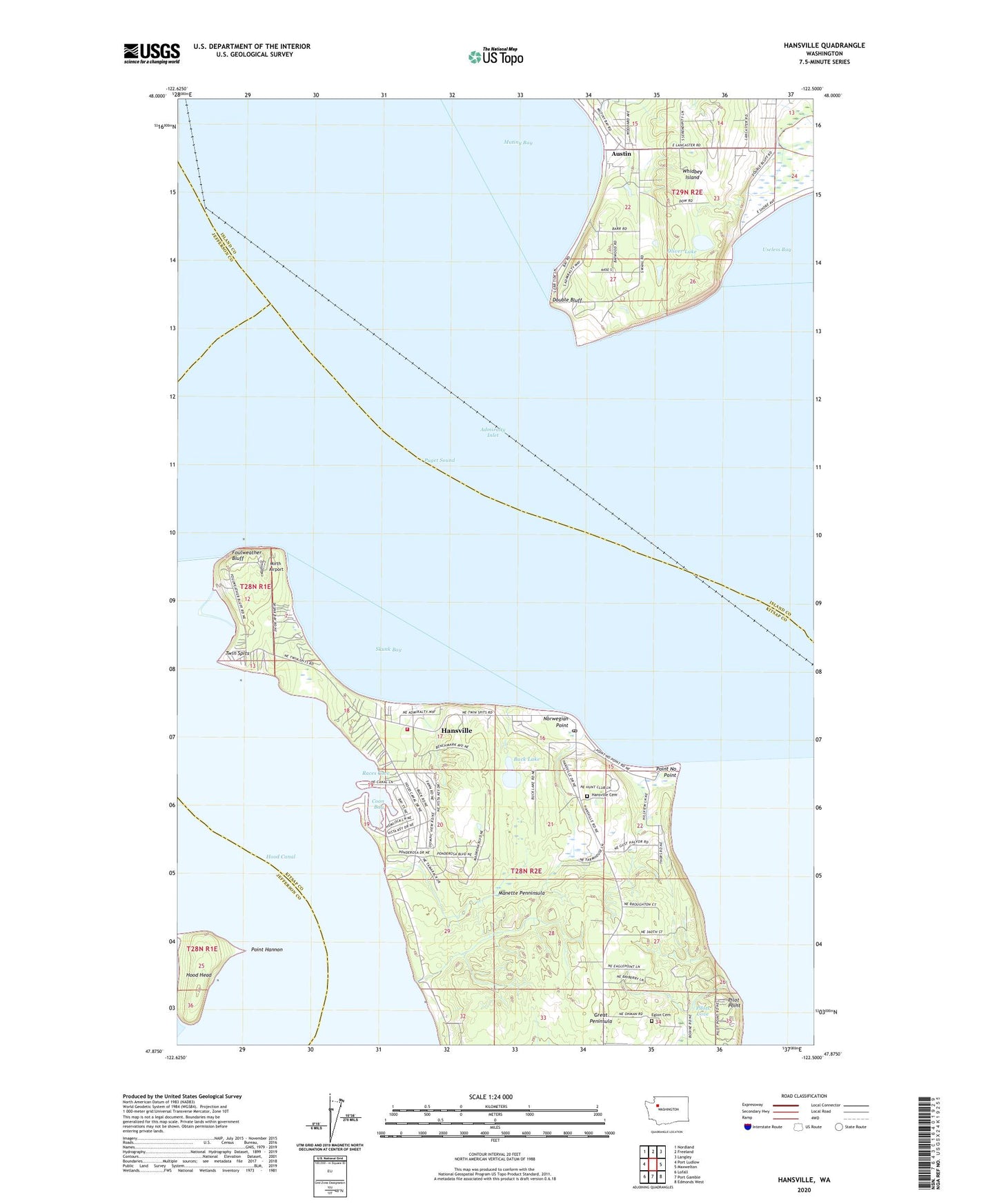
2020 topographic map quadrangle Hansville in the state of Washington. Scale: 1:24000. Based on the newly updated USGS 7.5' US Topo map series, this map is in the following counties: Kitsap, Island, Jefferson. The map contains contour data, water features, and other items you are used to seeing on USGS maps, but also has updated roads and other features. This is the next generation of topographic maps. Printed on high-quality waterproof paper with UV fade-resistant inks.
Quads adjacent to this one:
West: Port Ludlow
Northwest: Nordland
North: Freeland
Northeast: Langley
East: Maxwelton
Southeast: Edmonds West
South: Port Gamble
Southwest: Lofall
Contains the following named places: Austin, Buck Lake, Coon Bay, Dahlman Dam, Double Bluff, Double Bluff Light, Eglon Cemetery, Foulweather Bluff, Hansville, Hansville Cemetery, Hansville Census Designated Place, Hansville Community Church, Hansville Post Office, Hood Head, Manette Penninsula, Mirth Airport, Mutiny Bay, Mutiny Bay Boat Launch, North Kitsap Fire and Rescue Station 89 Hansville, Norwegian Point, Oliver Lake, Pilot Point, Pilots Cove, Point Hannon, Point Hannon Light, Point No Point, Point No Point Light, Races Cove, Raden Dam, Skunk Bay, Skunk Bay Light, Tahoma One Drop Zen Monastery, Twin Spits, Twin Spits Marina, ZIP Code: 98340