MyTopo
Port Ludlow Washington US Topo Map
Couldn't load pickup availability
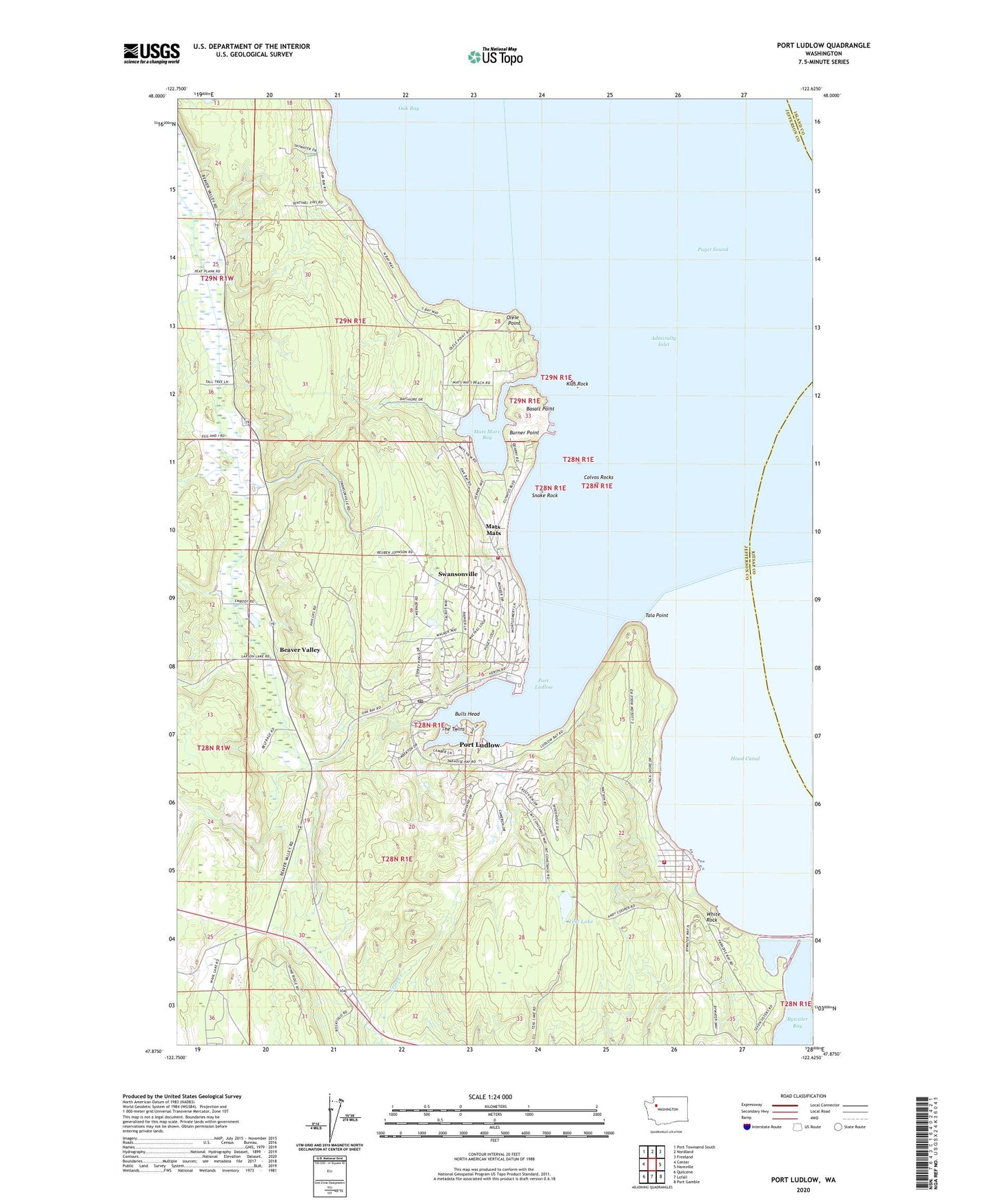
2023 topographic map quadrangle Port Ludlow in the state of Washington. Scale: 1:24000. Based on the newly updated USGS 7.5' US Topo map series, this map is in the following counties: Jefferson, Kitsap, Island. The map contains contour data, water features, and other items you are used to seeing on USGS maps, but also has updated roads and other features. This is the next generation of topographic maps. Printed on high-quality waterproof paper with UV fade-resistant inks.
Quads adjacent to this one:
West: Center
Northwest: Port Townsend South
North: Nordland
Northeast: Freeland
East: Hansville
Southeast: Port Gamble
South: Lofall
Southwest: Quilcene
This map covers the same area as the classic USGS quad with code o47122h6.
Contains the following named places: Basalt Point, Beaver Valley, Bulls Head, Burner Point, Bywater Bay, Colvos Rocks, Colvos Rocks Light, Cooper Creek, Grace Christian Center, Hansen Dam, Jefferson County Fire Protection District 3 Port Ludlow Fire and Rescue Station 31 Headquarters, Jefferson County Fire Protection District 3 Port Ludlow Fire and Rescue Station 32, Klas Rock, Mats Mats, Mats Mats Bay, Mats Mats Bay Yacht Club, Mats Mats Quarry, Oak Bay, Oak Bay-Port Ludlow Division, Olele Point, Port Ludlow, Port Ludlow Census Designated Place, Port Ludlow Community Church, Port Ludlow Golf Resort, Port Ludlow Marina, Port Ludlow Post Office, Port Ludlow Recreational Vehicle Park, Snake Rock, Swansonville, Tala Point, Teal Lake, The Twins, Thorndyke Pit Road Quarry, White Rock, Witter Dam, ZIP Code: 98365