MyTopo
Freeland Washington US Topo Map
Couldn't load pickup availability
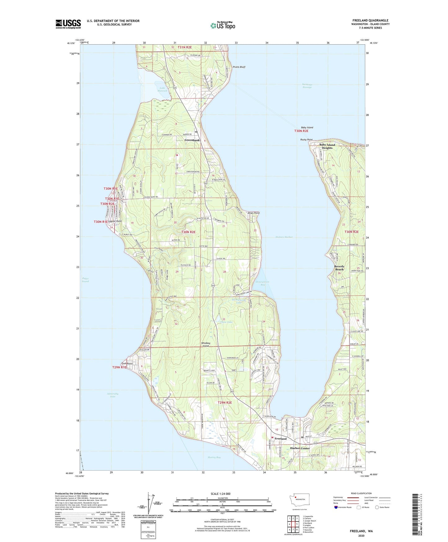
2023 topographic map quadrangle Freeland in the state of Washington. Scale: 1:24000. Based on the newly updated USGS 7.5' US Topo map series, this map is in the following counties: Island. The map contains contour data, water features, and other items you are used to seeing on USGS maps, but also has updated roads and other features. This is the next generation of topographic maps. Printed on high-quality waterproof paper with UV fade-resistant inks.
Quads adjacent to this one:
West: Nordland
Northwest: Coupeville
North: Camano
Northeast: Juniper Beach
East: Langley
Southeast: Maxwelton
South: Hansville
Southwest: Port Ludlow
This map covers the same area as the classic USGS quad with code o48122a5.
Contains the following named places: Admiralty Inlet, Baby Island, Baby Island Heights, Beverly Beach, Bush Point, Bush Point Boat Launch, Bush Point Light, Chase Lake, Christian Life Ministry Center, Dines Point, Freeland, Freeland Census Designated Place, Freeland Landfill, Freeland Library, Freeland Post Office, Greenbank, Greenbank Post Office, Harbor Center, Holmes Harbor, Holmes Harbor Golf and Beach Club, Holmes Harbor Mobile Home Court, Holmes Harbor Wastewater Treatment Plant, Honeymoon Bay, Honeymoon Lake, Honeymoon Lake Dam, Island County Fire District 5 Central Whidbey Island Fire and Rescue Station 54, Island County Fire Protection District 3 South Whidbey Fire / EMS Freeland Station 31, Kingdom Hall of Jehovahs Witnesses, Lagoon Point, Lake Hancock, Meerkerk Rhododendron Gardens, Pratts Bluff, Rocky Point, Saint Augustines in the Woods Episcopal Church, Saint Augustine's Preschool, South Whidbey Island State Park, Trinity Lutheran Church, Whidbey Evangelical Free Church, ZIP Codes: 98249, 98253