MyTopo
Maxwelton Washington US Topo Map
Couldn't load pickup availability
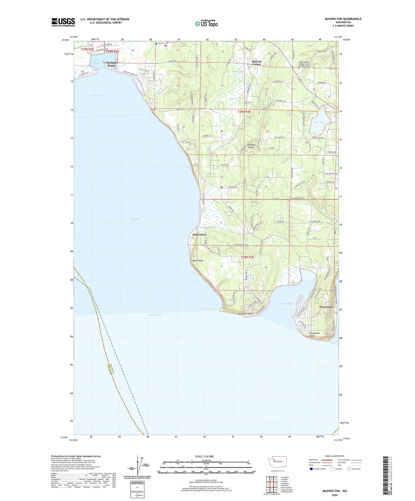
2023 topographic map quadrangle Maxwelton in the state of Washington. Scale: 1:24000. Based on the newly updated USGS 7.5' US Topo map series, this map is in the following counties: Island, Kitsap, Snohomish. The map contains contour data, water features, and other items you are used to seeing on USGS maps, but also has updated roads and other features. This is the next generation of topographic maps. Printed on high-quality waterproof paper with UV fade-resistant inks.
Quads adjacent to this one:
West: Hansville
Northwest: Freeland
North: Langley
Northeast: Tulalip
East: Mukilteo
Southeast: Edmonds East
South: Edmonds West
Southwest: Port Gamble
This map covers the same area as the classic USGS quad with code o47122h4.
Contains the following named places: Bayview Cemetery, Calvary Chapel, Cultus Bay, Dave Mackie County Park, Deer Lagoon, Deer Lake, Indian Point, Island County Fire Protection District 3 South Whidbey Fire / EMS Bayview Station 36, Island County Fire Protection District 3 South Whidbey Fire / EMS Maxwelton Station 33, Ken's Korner Shopping Plaza, Maxwelton, Midvale Corner, Miller Lake, Possession, Possession Point, Sandy Hook Yacht Club Estates, Scatchet Head, South Whidbey Island Division, Sunlight Beach, Toddle Inn Daycare Center, Useless Bay, Whidbey Island Waldorf School, ZIP Code: 98236