MyTopo
Hobart Washington US Topo Map
Couldn't load pickup availability
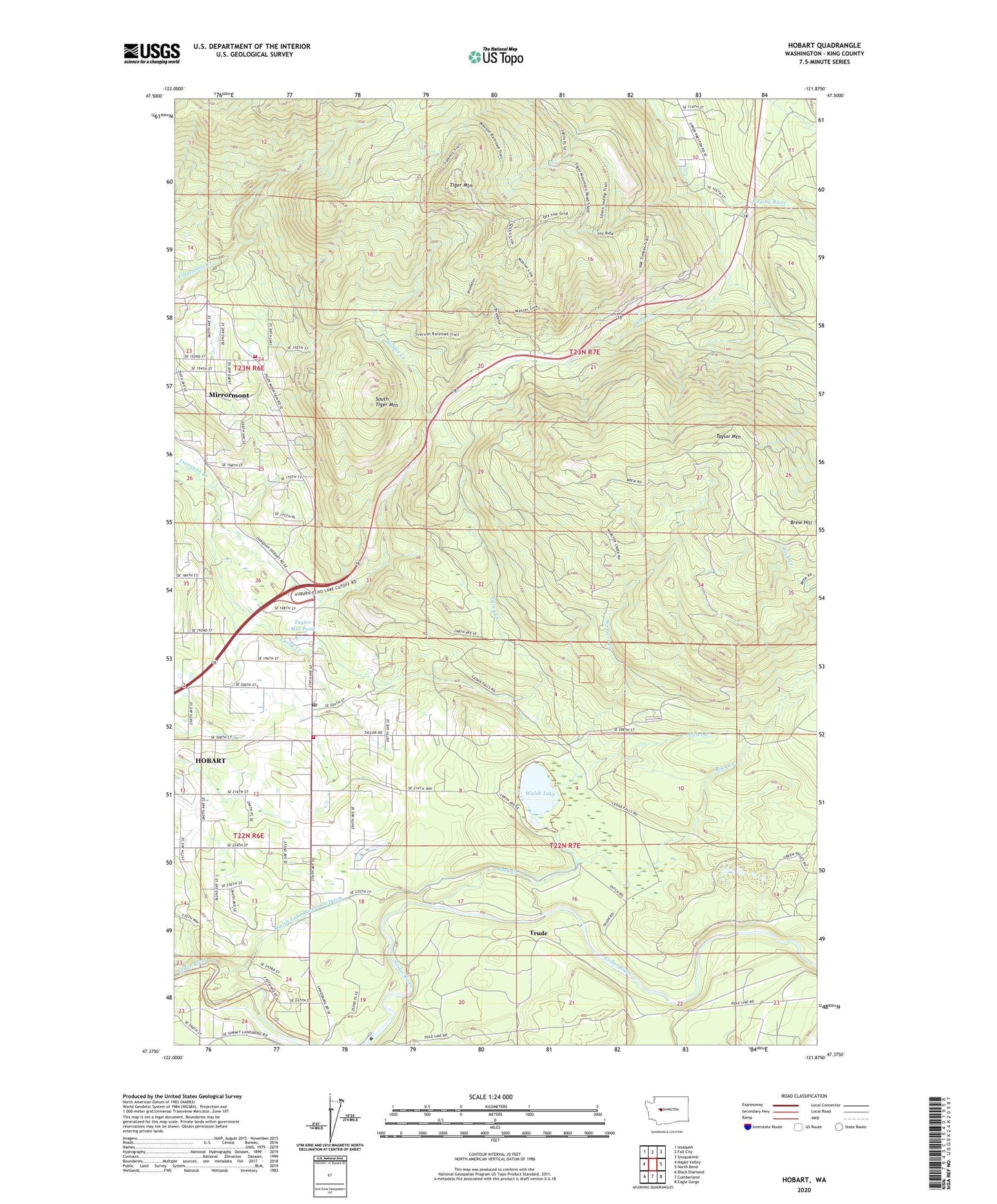
2023 topographic map quadrangle Hobart in the state of Washington. Scale: 1:24000. Based on the newly updated USGS 7.5' US Topo map series, this map is in the following counties: King. The map contains contour data, water features, and other items you are used to seeing on USGS maps, but also has updated roads and other features. This is the next generation of topographic maps. Printed on high-quality waterproof paper with UV fade-resistant inks.
Quads adjacent to this one:
West: Maple Valley
Northwest: Issaquah
North: Fall City
Northeast: Snoqualmie
East: North Bend
Southeast: Eagle Gorge
South: Cumberland
Southwest: Black Diamond
This map covers the same area as the classic USGS quad with code o47121d8.
Contains the following named places: Brew Hill, Carey Creek, Deep Creek, Eastside Fire and Rescue Battalion 3 Station 76 - Tiger Mountain, Hobart, Hobart Census Designated Place, Hobart Post Office, Hobart School, Holder Creek, Holmes Dam, Hotel Creek, King County Fire Protection District 43 Maple Valley Fire and Life Safety Station 85, Levdansky County Park, Mirrormont, Mirrormont Census Designated Place, Rock Creek, Seattle Water Supply Intake, Shingle Mill, South Tiger Mountain, Tahoma-Maple Valley Division, Taylor, Taylor Mill Pond, Taylor Mill Pond Dam, Taylor Mountain, Tiger Mountain, Tiger Mountain Lookout, Tiger Mountain State Forest, Tiger Mountain Trail, Trude, Walsh Lake, Walsh Lake Diversion Ditch, Walsh Lake Nursery, Webster Creek, ZIP Codes: 98027, 98038