MyTopo
Snoqualmie Washington US Topo Map
Couldn't load pickup availability
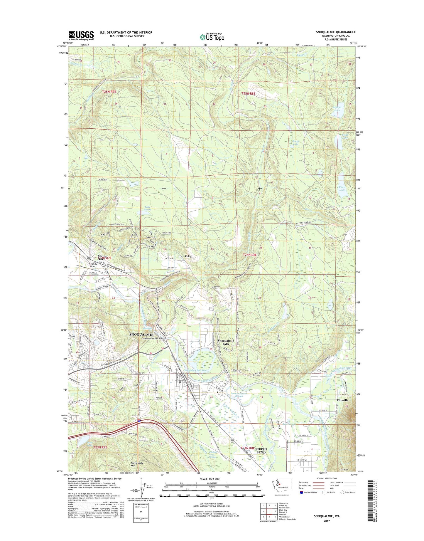
2023 topographic map quadrangle Snoqualmie in the state of Washington. Scale: 1:24000. Based on the newly updated USGS 7.5' US Topo map series, this map is in the following counties: King. The map contains contour data, water features, and other items you are used to seeing on USGS maps, but also has updated roads and other features. This is the next generation of topographic maps. Printed on high-quality waterproof paper with UV fade-resistant inks.
Quads adjacent to this one:
West: Fall City
Northwest: Carnation
North: Lake Joy
Northeast: Devils Slide
East: Mount Si
Southeast: Chester Morse Lake
South: North Bend
Southwest: Hobart
This map covers the same area as the classic USGS quad with code o47121e7.
Contains the following named places: Borst Lake, Boyle Lake, Bridges Lake, Brockway Creek, City of Snoqualmie, Coal Creek, East Fork Kimball Creek, Echo Lake, Echo Lake Dam, Ellisville, Fall City Airport, Junction, Kimball Creek, Kimball Creek Swamp, King County Sheriff North Bend, Kings Lake, Klaus Lake, Lake Marie, Meadowbrook Slough, Middle Fork Snoqualmie River, Mount Si Golf Course, Mount Si High School, Mountain View School, Mud Creek, North Bend Police, North Fork Snoqualmie River, Reid Slough, Skunk Creek, Snoqualmie, Snoqualmie Diversion Dam, Snoqualmie Elementary School, Snoqualmie Falls, Snoqualmie Fire Department, Snoqualmie Middle School, Snoqualmie Mill Pond, Snoqualmie Mill Pond Dam, Snoqualmie Post Office, Snoqualmie Reservation, Snoqualmie Ridge Golf Course, Snoqualmie River Bridge, Snoqualmie Sewage Treatment Plant, Snoqualmie Valley Christian School, Snoqualmie Valley School District Office, South Fork Snoqualmie River, Spring Glen, Spring Glen Mobile Home Park, Tate Creek, Ten Creek, Tokul, Tokul Creek, ZIP Code: 98065