MyTopo
North Bend Washington US Topo Map
Couldn't load pickup availability
Also explore the North Bend Forest Service Topo of this same quad for updated USFS data
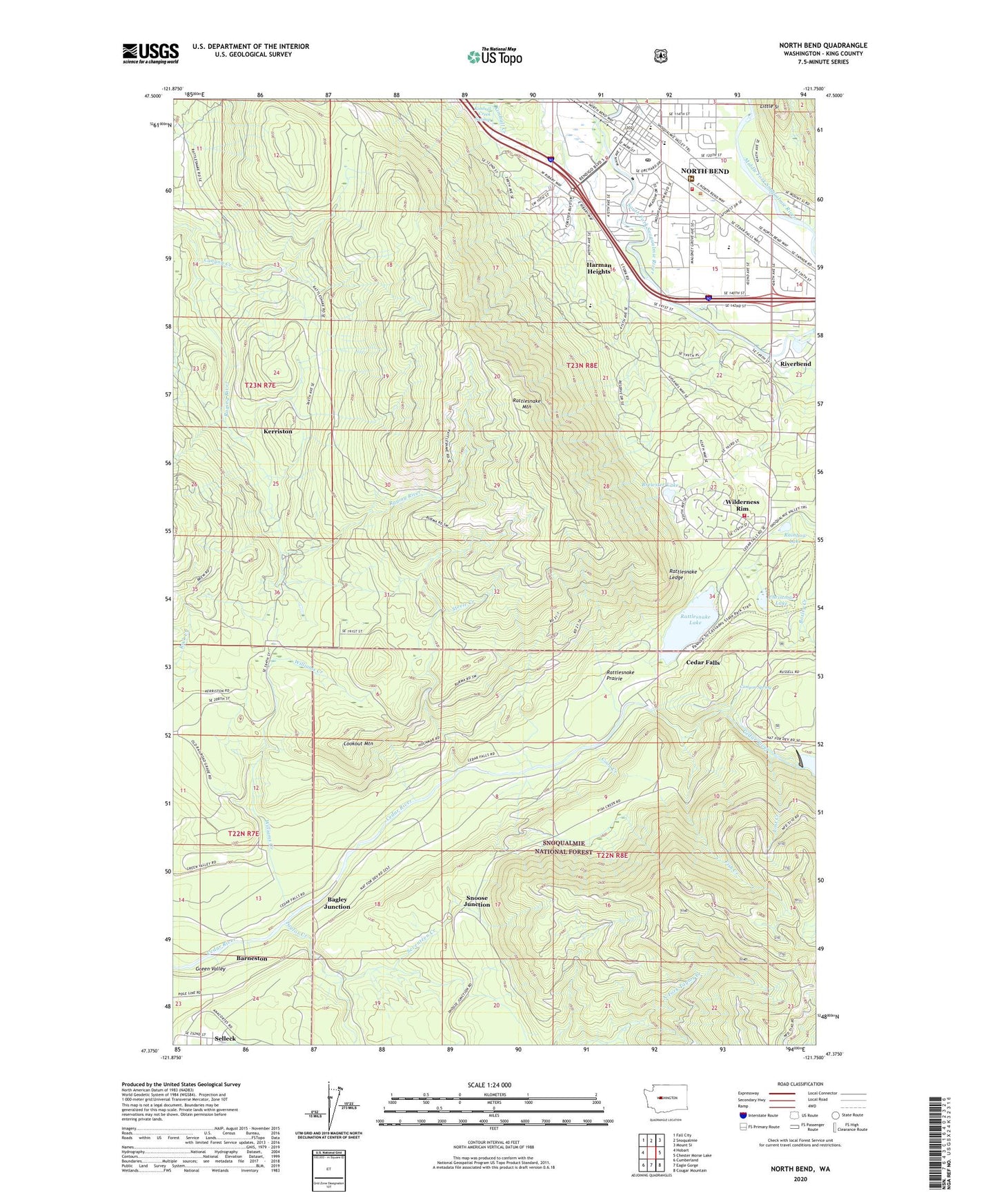
2023 topographic map quadrangle North Bend in the state of Washington. Scale: 1:24000. Based on the newly updated USGS 7.5' US Topo map series, this map is in the following counties: King. The map contains contour data, water features, and other items you are used to seeing on USGS maps, but also has updated roads and other features. This is the next generation of topographic maps. Printed on high-quality waterproof paper with UV fade-resistant inks.
Quads adjacent to this one:
West: Hobart
Northwest: Fall City
North: Snoqualmie
Northeast: Mount Si
East: Chester Morse Lake
Southeast: Cougar Mountain
South: Eagle Gorge
Southwest: Cumberland
This map covers the same area as the classic USGS quad with code o47121d7.
Contains the following named places: Bagley Junction, Barneston, Brewster Lake, Canyon Creek, Canyon Spring, Cascade Golf Course, Cedar Falls, Cedar Point Lookout, Christmas Lake, City of North Bend, Coon Creek, E J Roberts Park, Eastside Fire and Rescue Battalion 5 Station 87 North Bend, Eastside Fire and Rescue Battalion 5 Station 88 - Wilderness Rim, Eastside Fire and Rescue Station 87, Fish Creek, Gardner Weeks Park, Green Valley, Harman Heights, Hemlock, Kerriston, King County, Little Si, Lookout Mountain, Lost Creek, Lower Dam, Masonry Dam, Mount Si Mobile Home Park, Mount Si Transitional Health Center, Mountain Tree Farm Center, North Bend, North Bend Elementary School, North Bend Post Office, North Bend Ranger Station, North Bend Sewage Treatment Plant, Opstad Elementary School, Rainbow Lake, Rattlesnake Lake, Rattlesnake Ledge, Rattlesnake Mountain, Rattlesnake Prairie, Riverbend, Selleck, Seventeen Creek, Si View County Park, Snoose Junction, Steele Creek, Taylor Creek, Two Rivers School, Wilderness Rim Census Designated Place, Williams Creek