MyTopo
Hoffstadt Mountain Washington US Topo Map
Couldn't load pickup availability
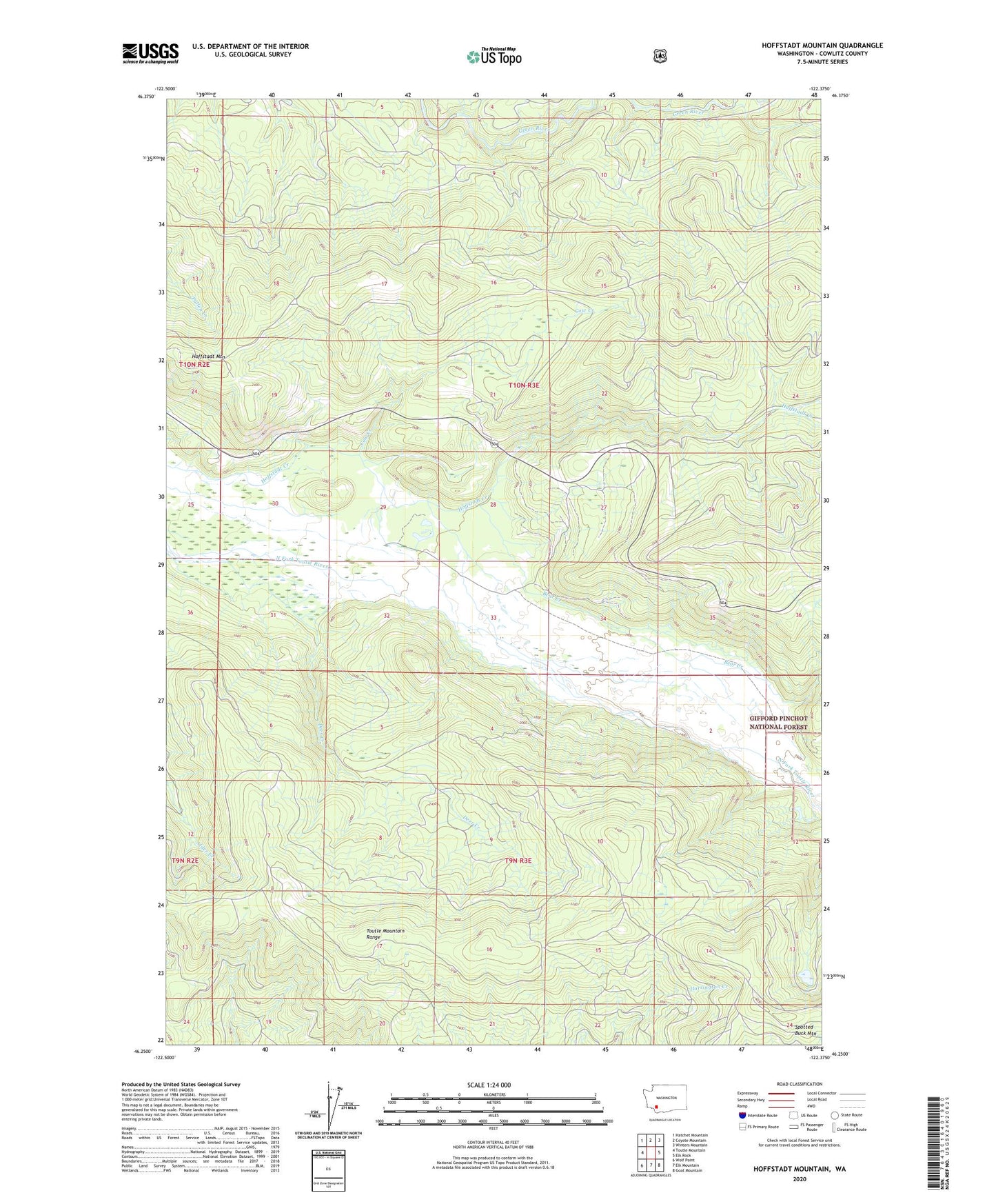
2020 topographic map quadrangle Hoffstadt Mountain in the state of Washington. Scale: 1:24000. Based on the newly updated USGS 7.5' US Topo map series, this map is in the following counties: Cowlitz. The map contains contour data, water features, and other items you are used to seeing on USGS maps, but also has updated roads and other features. This is the next generation of topographic maps. Printed on high-quality waterproof paper with UV fade-resistant inks.
Quads adjacent to this one:
West: Toutle Mountain
Northwest: Hatchet Mountain
North: Coyote Mountain
Northeast: Winters Mountain
East: Elk Rock
Southeast: Goat Mountain
South: Elk Mountain
Southwest: Wolf Point
Contains the following named places: Cow Creek, Debris Dam Viewpoint, Deer Creek, Hoffstadt Mountain, Hoffstadt Viewpoint Heliport, North Fork Toutle Debris Dam A, North Fork Toutle Debris Dam B, Spotted Buck Mountain, Toutle Dam