MyTopo
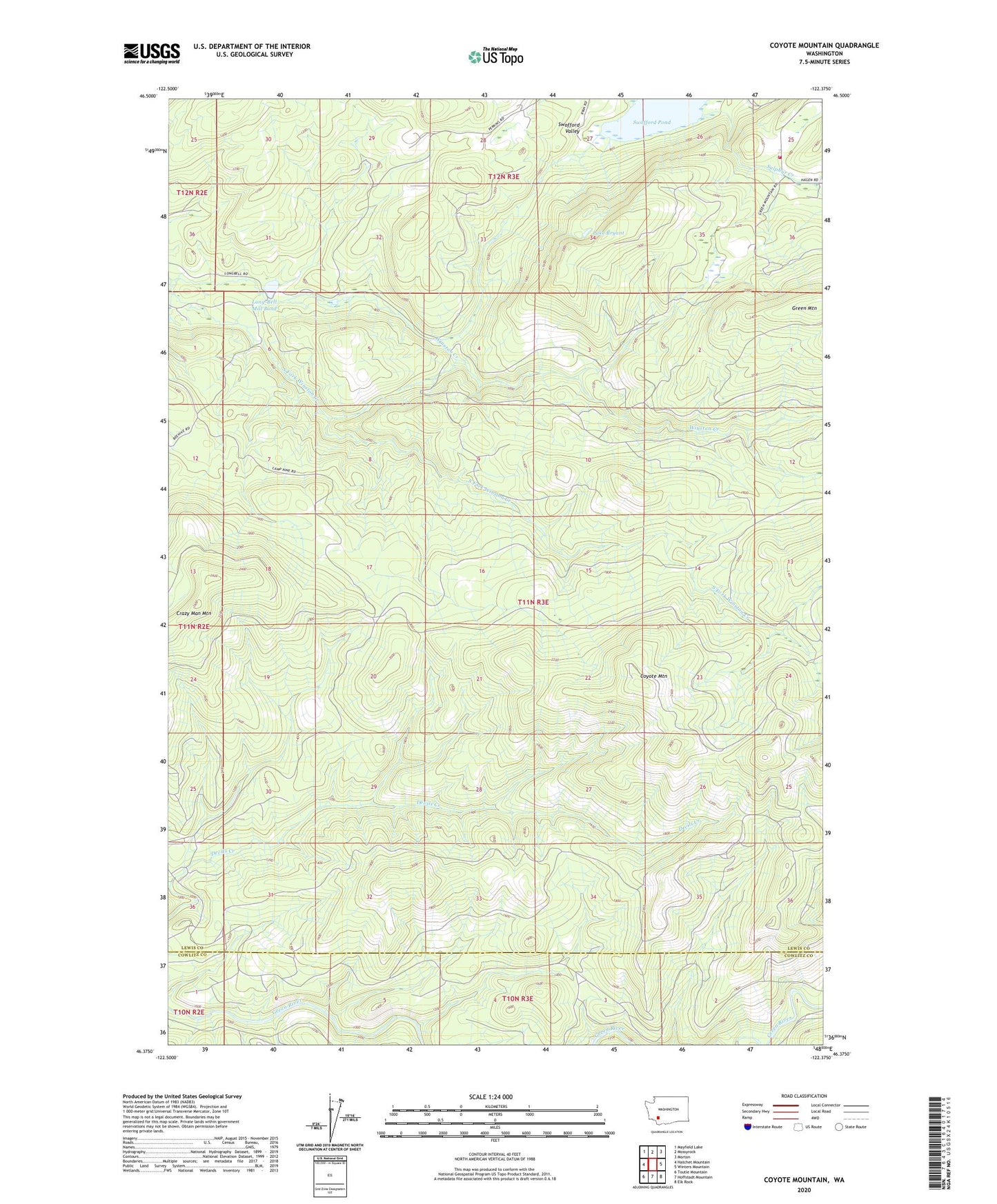
Coyote Mountain Washington US Topo Map
Couldn't load pickup availability
Also explore the Coyote Mountain Forest Service Topo of this same quad for updated USFS data
2023 topographic map quadrangle Coyote Mountain in the state of Washington. Scale: 1:24000. Based on the newly updated USGS 7.5' US Topo map series, this map is in the following counties: Lewis, Cowlitz. The map contains contour data, water features, and other items you are used to seeing on USGS maps, but also has updated roads and other features. This is the next generation of topographic maps. Printed on high-quality waterproof paper with UV fade-resistant inks.
Quads adjacent to this one:
West: Hatchet Mountain
Northwest: Mayfield Lake
North: Mossyrock
Northeast: Morton
East: Winters Mountain
Southeast: Elk Rock
South: Hoffstadt Mountain
Southwest: Toutle Mountain
This map covers the same area as the classic USGS quad with code o46122d4.
Contains the following named places: Camp 10, Camp 9, Cowlitz, Coyote Mountain, Crazy Man Mountain, Lake Bryant, Lewis County Fire District 3 Station 2, Long-Bell Mill Pond, Long-Bell Mill Pond Dam, Shingle Mill, South Fork Winston Creek, Swofford Pond, Thurston Creek, ZIP Code: 98564