MyTopo
Hatchet Mountain Washington US Topo Map
Couldn't load pickup availability
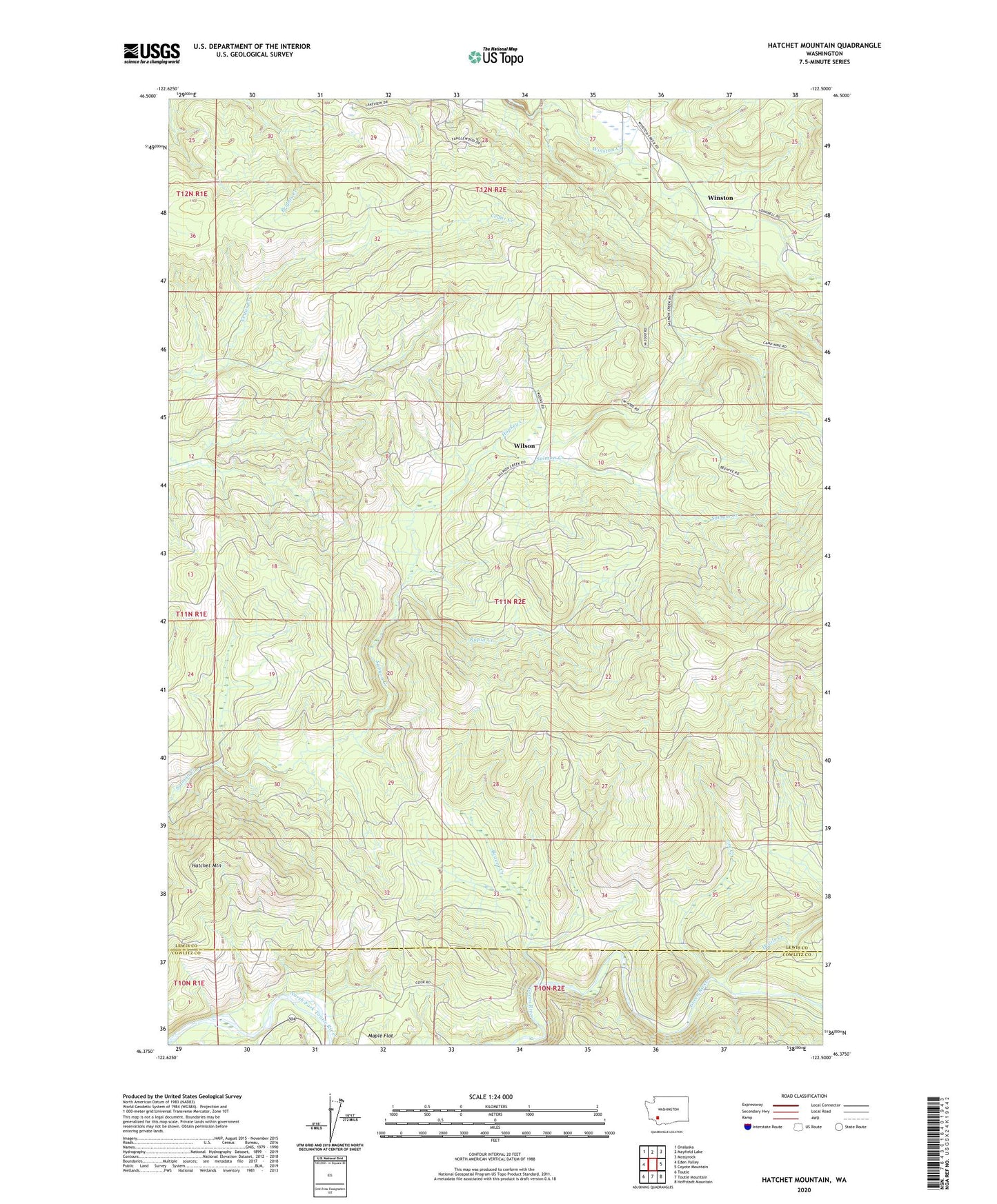
2023 topographic map quadrangle Hatchet Mountain in the state of Washington. Scale: 1:24000. Based on the newly updated USGS 7.5' US Topo map series, this map is in the following counties: Lewis, Cowlitz. The map contains contour data, water features, and other items you are used to seeing on USGS maps, but also has updated roads and other features. This is the next generation of topographic maps. Printed on high-quality waterproof paper with UV fade-resistant inks.
Quads adjacent to this one:
West: Eden Valley
Northwest: Onalaska
North: Mayfield Lake
Northeast: Mossyrock
East: Coyote Mountain
Southeast: Hoffstadt Mountain
South: Toutle Mountain
Southwest: Toutle
This map covers the same area as the classic USGS quad with code o46122d5.
Contains the following named places: Beaver Creek, Devils Creek, Hatchet Mountain, Hopkey Creek, Jim Creek, Maple Flat, Mossyrock Division, Nineteen Mile Camp, Rapid Creek, Wilson, Winston, Winston Creek Campground