MyTopo
Hoh Head Washington US Topo Map
Couldn't load pickup availability
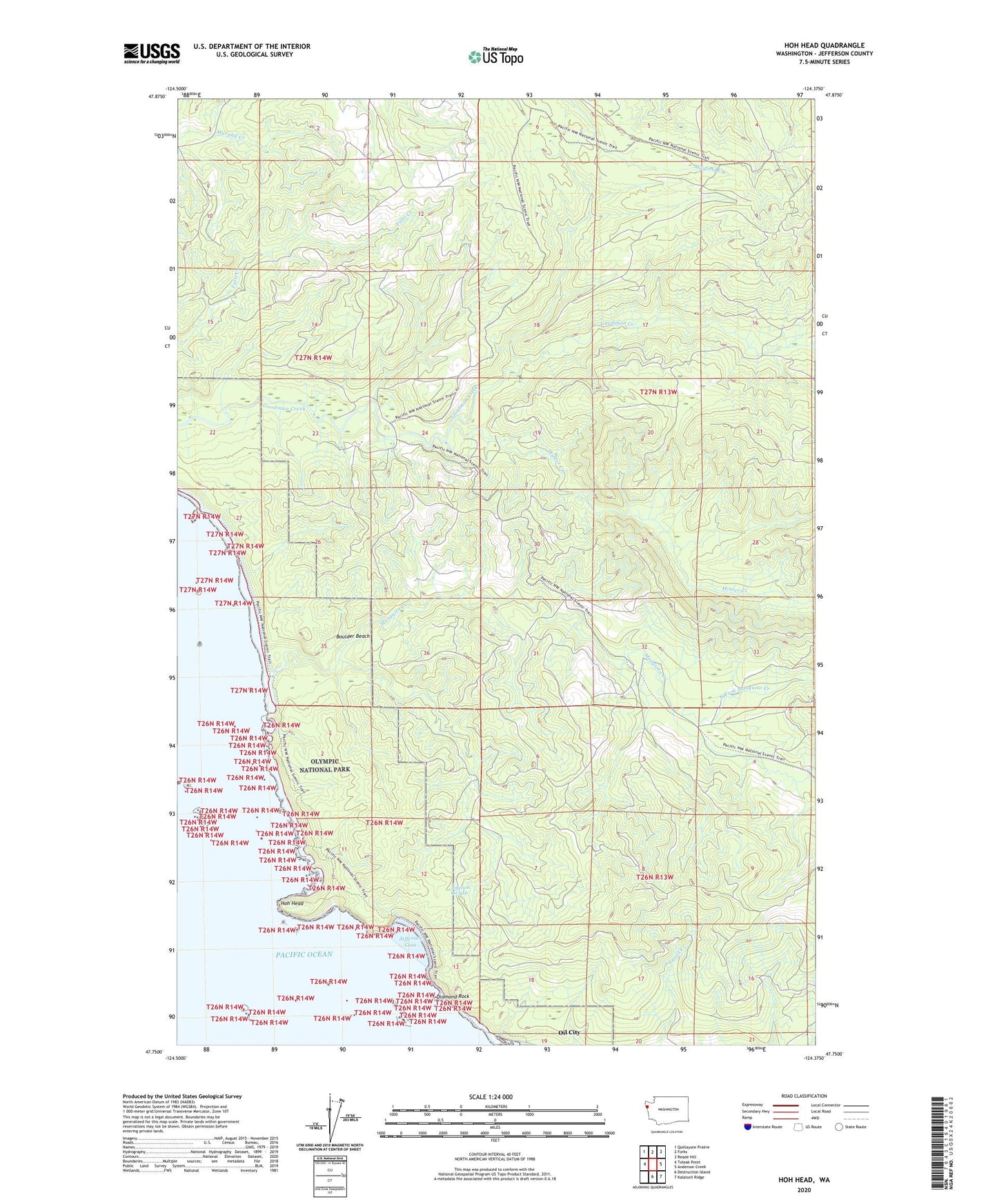
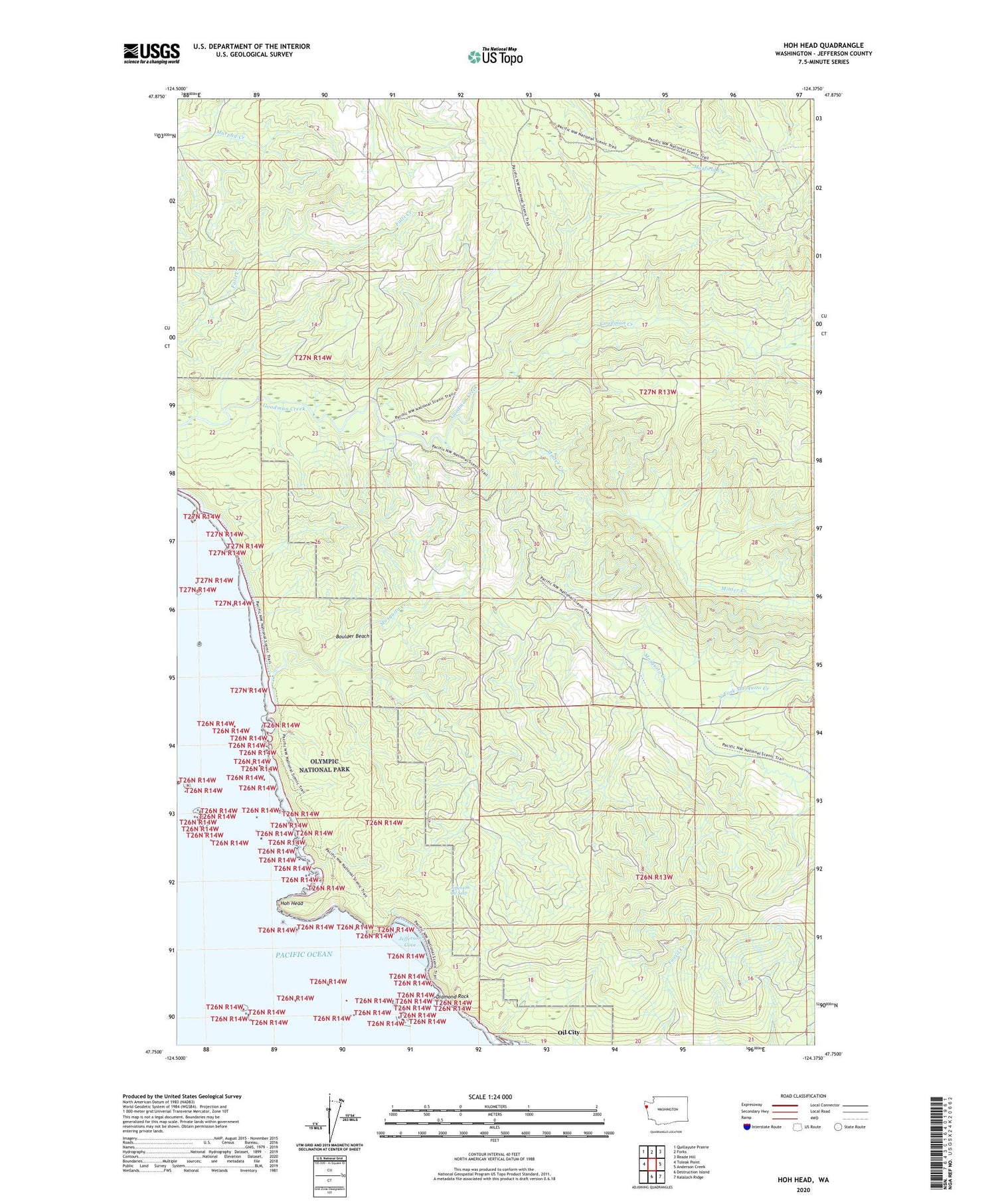
2020 topographic map quadrangle Hoh Head in the state of Washington. Scale: 1:24000. Based on the newly updated USGS 7.5' US Topo map series, this map is in the following counties: Jefferson. The map contains contour data, water features, and other items you are used to seeing on USGS maps, but also has updated roads and other features. This is the next generation of topographic maps. Printed on high-quality waterproof paper with UV fade-resistant inks.
Quads adjacent to this one:
West: Toleak Point
Northwest: Quillayute Prairie
North: Forks
Northeast: Reade Hill
East: Anderson Creek
Southeast: Kalaloch Ridge
South: Destruction Island
Contains the following named places: Boulder Beach, Diamond Rock, Hoh Head, Jefferson Cove, Jefferson Oil Seep, Minter Creek, Mosquito Creek, North Fork Mosquito Creek, Oil City