MyTopo
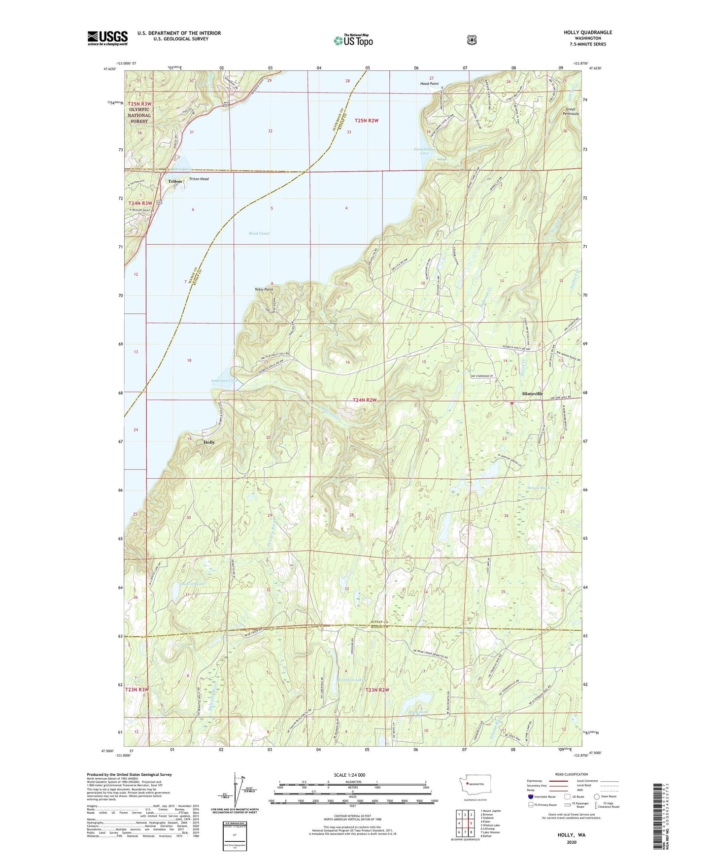
Holly Washington US Topo Map
Couldn't load pickup availability
Also explore the Holly Forest Service Topo of this same quad for updated USFS data
2023 topographic map quadrangle Holly in the state of Washington. Scale: 1:24000. Based on the newly updated USGS 7.5' US Topo map series, this map is in the following counties: Kitsap, Mason, Jefferson. The map contains contour data, water features, and other items you are used to seeing on USGS maps, but also has updated roads and other features. This is the next generation of topographic maps. Printed on high-quality waterproof paper with UV fade-resistant inks.
Quads adjacent to this one:
West: Eldon
Northwest: Mount Jupiter
North: Brinnon
Northeast: Seabeck
East: Wildcat Lake
Southeast: Belfair
South: Lake Wooten
Southwest: Lilliwaup
This map covers the same area as the classic USGS quad with code o47122e8.
Contains the following named places: Anderson Cove, Anderson Creek, Blacksmith Lake, Boyce Creek, Central Kitsap Fire and Rescue Station 54 Hintzville, Erickson Lake, Frenchmans Cove, Fulton Creek, Hintzville, Hintzville Beaver Ponds, Holly, Holly Pit, Hood Point, Ludvick Lake, Morgan Marsh, Nellita, Tekiu Point, Triton, Triton Cove, Triton Head, ZIP Code: 98380