MyTopo
Mount Jupiter Washington US Topo Map
Couldn't load pickup availability
Also explore the Mount Jupiter Forest Service Topo of this same quad for updated USFS data
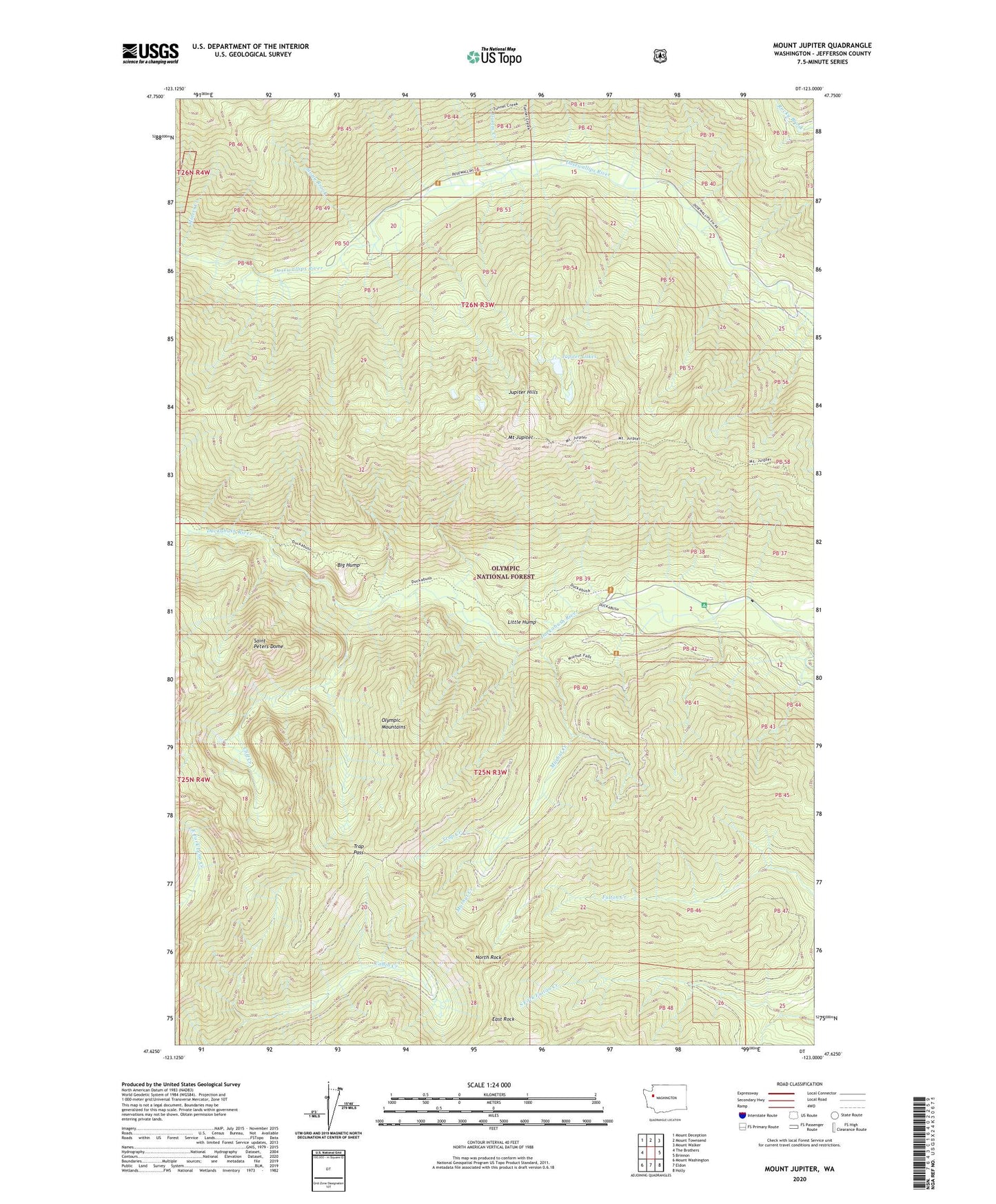
2023 topographic map quadrangle Mount Jupiter in the state of Washington. Scale: 1:24000. Based on the newly updated USGS 7.5' US Topo map series, this map is in the following counties: Jefferson. The map contains contour data, water features, and other items you are used to seeing on USGS maps, but also has updated roads and other features. This is the next generation of topographic maps. Printed on high-quality waterproof paper with UV fade-resistant inks.
Quads adjacent to this one:
West: The Brothers
Northwest: Mount Deception
North: Mount Townsend
Northeast: Mount Walker
East: Brinnon
Southeast: Holly
South: Eldon
Southwest: Mount Washington
This map covers the same area as the classic USGS quad with code o47123f1.
Contains the following named places: Big Hump, Camp Collins, Cliff Creek, East Rock, Elkhorn Camp, Gamm Creek, Gamm Creek Camp, Jupiter Hills, Jupiter Lakes, Little Hump, Milwaukee Creek, Miners Creek, Mount Jupiter, Mount Jupiter Lookout, Murhut Creek, Ninemile Camp, North Rock, Saint Peters Dome, Stony Brook, Tenmile Camp, The Brothers Wilderness, Trap Creek, Trap Pass