
MyTopo
Hungry Mountain Washington US Topo Map
Couldn't load pickup availability
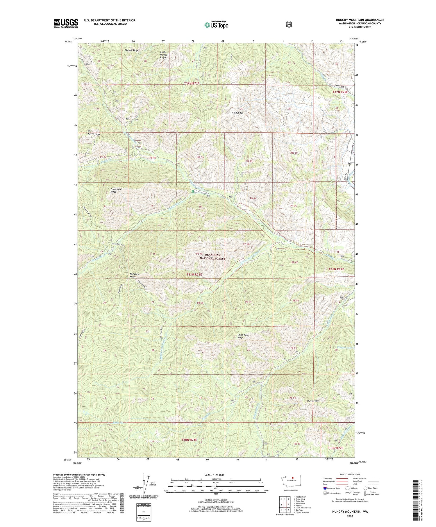
2020 topographic map quadrangle Hungry Mountain in the state of Washington. Scale: 1:24000. Based on the newly updated USGS 7.5' US Topo map series, this map is in the following counties: Okanogan. The map contains contour data, water features, and other items you are used to seeing on USGS maps, but also has updated roads and other features. This is the next generation of topographic maps. Printed on high-quality waterproof paper with UV fade-resistant inks.
Quads adjacent to this one:
West: Martin Peak
Northwest: Hoodoo Peak
North: Twisp West
Northeast: Twisp East
East: Methow
Southeast: Cooper Mountain
South: Oss Peak
Southwest: South Navarre Peak
Contains the following named places: Bear Camp, Buckhorn Canyon, Crater Creek, Crater Creek Campground, Foggy Dew Campground, Foggy Dew Creek, Foggy Dew Ranger Station, Gold Ridge, Grouse Hollow, Hornet Ridge, Hungry Mountain, Little Hornet Ridge, Middle Fork Gold Creek, North Fork Gold Creek, Oxide Canyon, Petes Canyon, Rainy Creek, South Fork Gold Creek, South Fork Ridge, Vinegar Lake, ZIP Code: 98814


