MyTopo
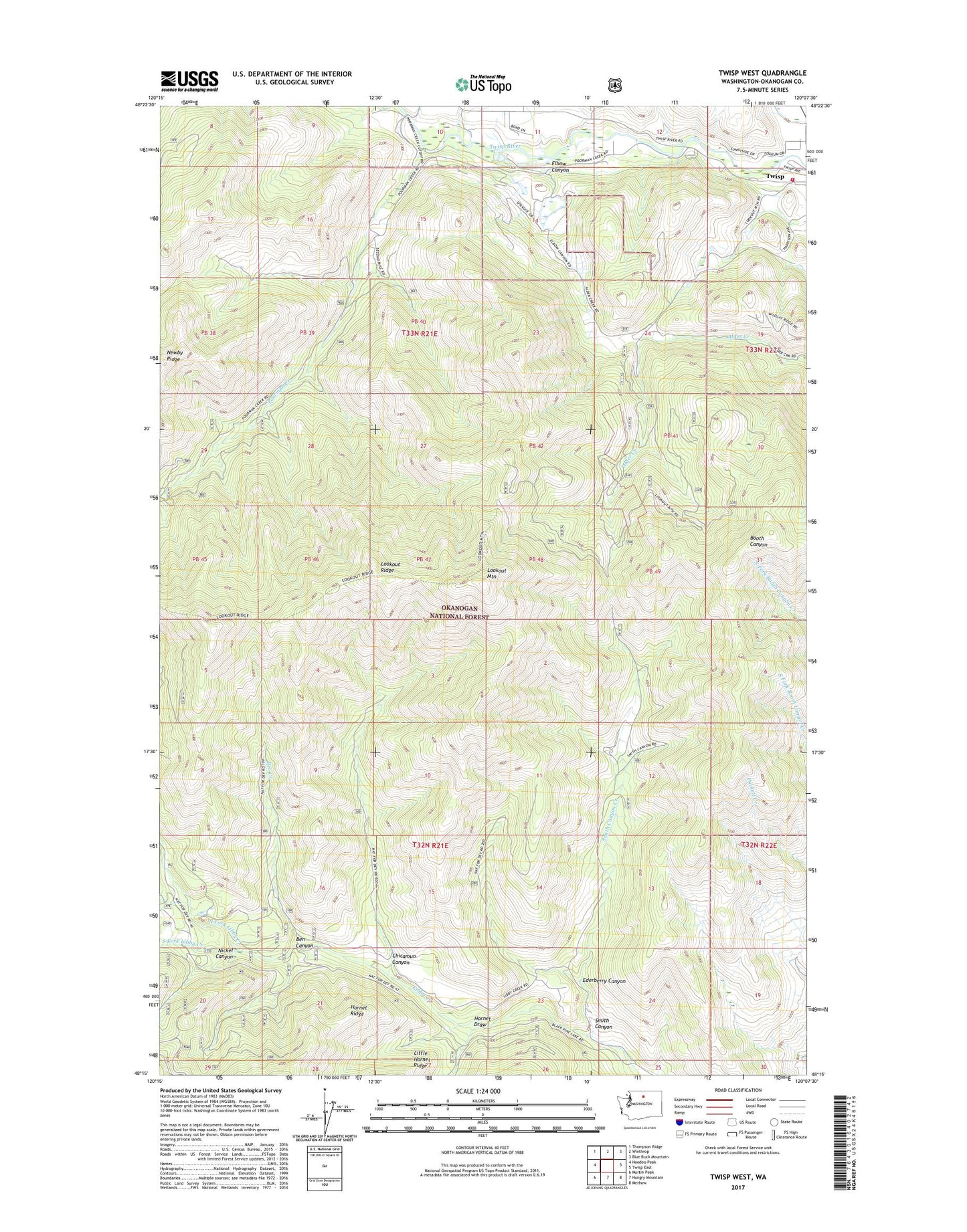
Twisp West Washington US Topo Map
Couldn't load pickup availability
Also explore the Twisp West Forest Service Topo of this same quad for updated USFS data
2023 topographic map quadrangle Twisp West in the state of Washington. Scale: 1:24000. Based on the newly updated USGS 7.5' US Topo map series, this map is in the following counties: Okanogan. The map contains contour data, water features, and other items you are used to seeing on USGS maps, but also has updated roads and other features. This is the next generation of topographic maps. Printed on high-quality waterproof paper with UV fade-resistant inks.
Quads adjacent to this one:
West: Hoodoo Peak
Northwest: Thompson Ridge
North: Winthrop
Northeast: Blue Buck Mountain
East: Twisp East
Southeast: Methow
South: Hungry Mountain
Southwest: Martin Peak
This map covers the same area as the classic USGS quad with code o48120c2.
Contains the following named places: Alder Mine, Allen Elementary School, Ben Canyon, Ben Creek, Chicamun Canyon, Ederberry Canyon, Elbow Canyon, Hornet Draw, Horseshoe Mobile Home Park, Lookout Mountain, Lookout Ridge, Methow Valley Division, Mission Creek, Nickel Canyon, North Fork Libby Creek, Okanogan County Fire Station 630, Poorman Creek, Smith Canyon, Smith Canyon Creek, South Fork Libby Creek