MyTopo
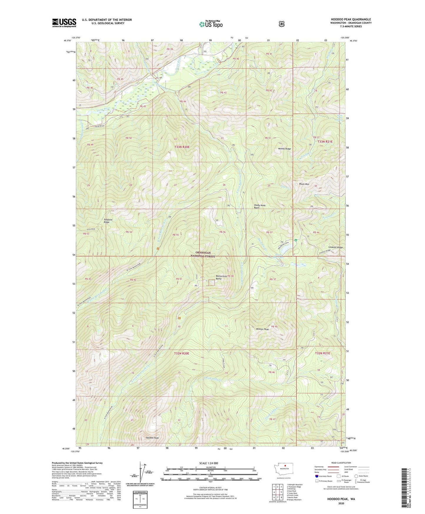
Hoodoo Peak Washington US Topo Map
Couldn't load pickup availability
Also explore the Hoodoo Peak Forest Service Topo of this same quad for updated USFS data
2023 topographic map quadrangle Hoodoo Peak in the state of Washington. Scale: 1:24000. Based on the newly updated USGS 7.5' US Topo map series, this map is in the following counties: Okanogan. The map contains contour data, water features, and other items you are used to seeing on USGS maps, but also has updated roads and other features. This is the next generation of topographic maps. Printed on high-quality waterproof paper with UV fade-resistant inks.
Quads adjacent to this one:
West: Oval Peak
Northwest: Midnight Mountain
North: Thompson Ridge
Northeast: Winthrop
East: Twisp West
Southeast: Hungry Mountain
South: Martin Peak
Southwest: Prince Creek
This map covers the same area as the classic USGS quad with code o48120c3.
Contains the following named places: Black Pine Creek, Black Pine Lake, Blackpine Lake Campground, Block Mountain, Buttermilk Butte, Buttermilk Creek, Canyon Creek, East Fork Buttermilk Creek, Hoodoo Peak, Horse Gulch, Horse Gulch Spring, Lime Creek, Mission Peak, Newby Ridge, Scaffold Camp Creek, Shady Nook Basin, West Fork Buttermilk Creek, Yoyo Creek, ZIP Code: 98856