MyTopo
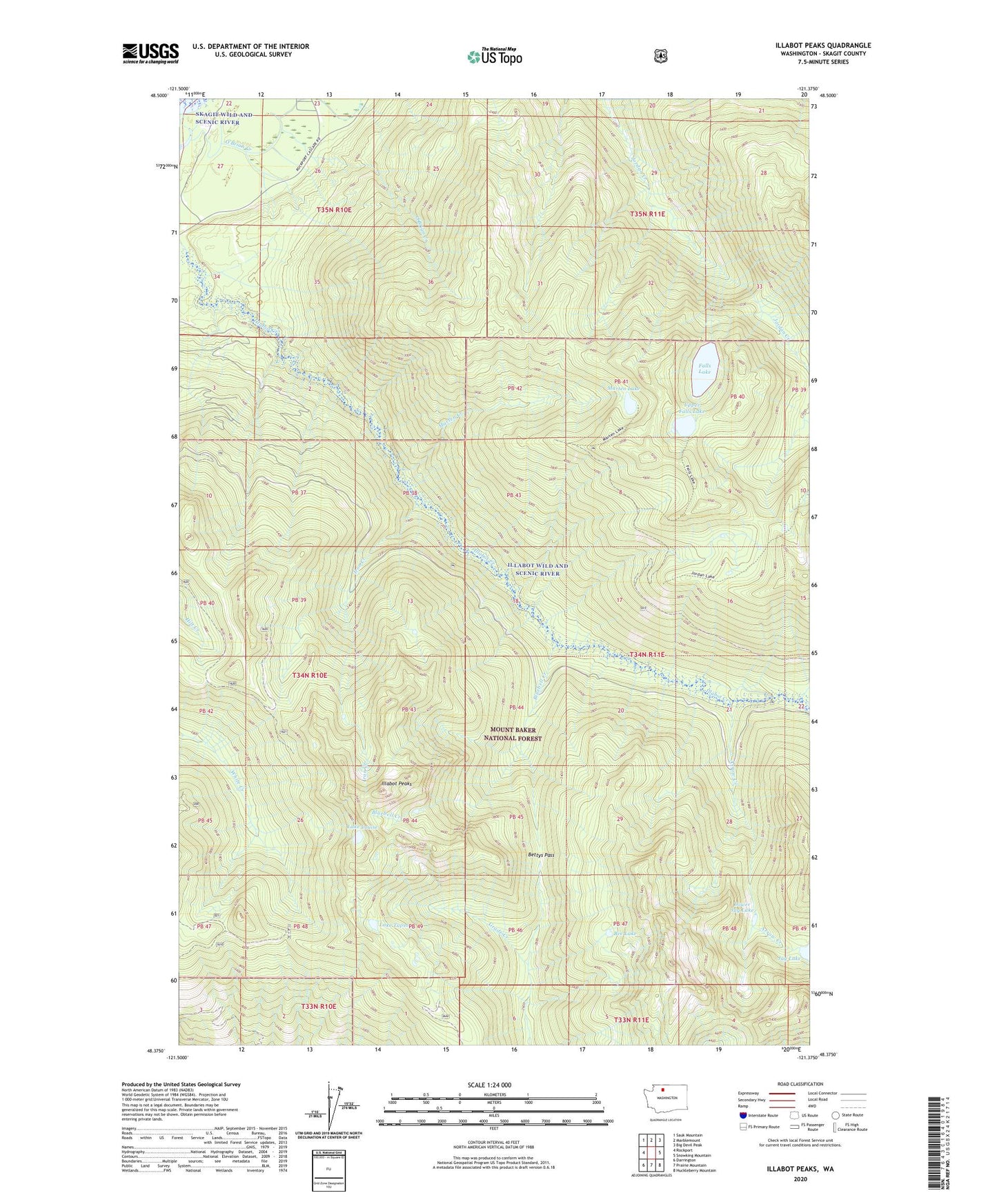
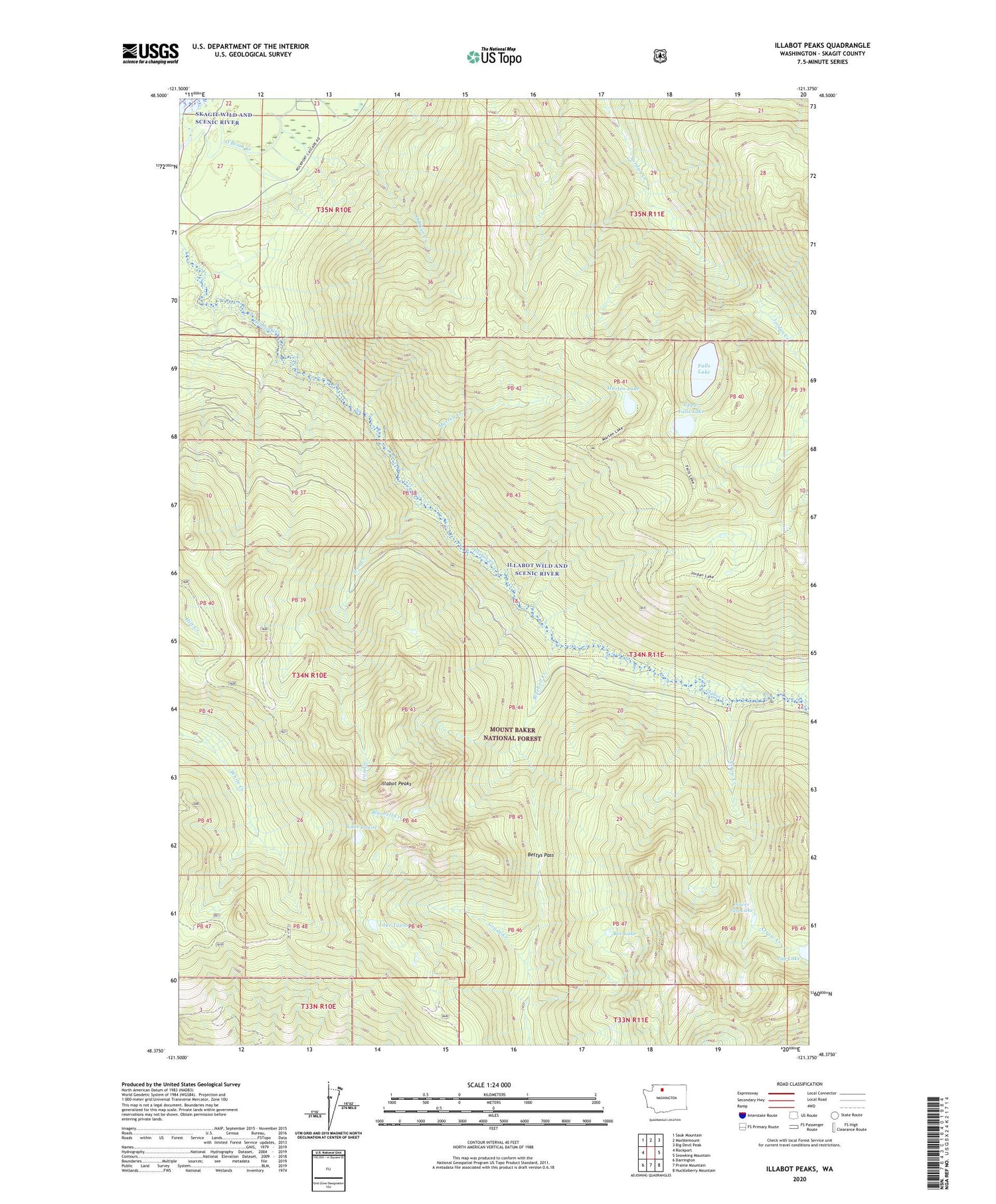
Illabot Peaks Washington US Topo Map
Couldn't load pickup availability
Also explore the Illabot Peaks Forest Service Topo of this same quad for updated USFS data
2023 topographic map quadrangle Illabot Peaks in the state of Washington. Scale: 1:24000. Based on the newly updated USGS 7.5' US Topo map series, this map is in the following counties: Skagit. The map contains contour data, water features, and other items you are used to seeing on USGS maps, but also has updated roads and other features. This is the next generation of topographic maps. Printed on high-quality waterproof paper with UV fade-resistant inks.
Quads adjacent to this one:
West: Rockport
Northwest: Sauk Mountain
North: Marblemount
Northeast: Big Devil Peak
East: Snowking Mountain
Southeast: Huckleberry Mountain
South: Prairie Mountain
Southwest: Darrington
This map covers the same area as the classic USGS quad with code o48121d4.
Contains the following named places: Arrow Creek, Bee Lake, Bettys Pass, Bluebell Creek, Falls Lake, Illabot Peaks, Illabot Wild and Scenic River, Iron Creek, Lake Louise, Lake Tupso, Lower Jug Lake, Marten Creek, Marten Lake, O'Brian Creek, O'Brien Creek, Upper Falls Lake