MyTopo
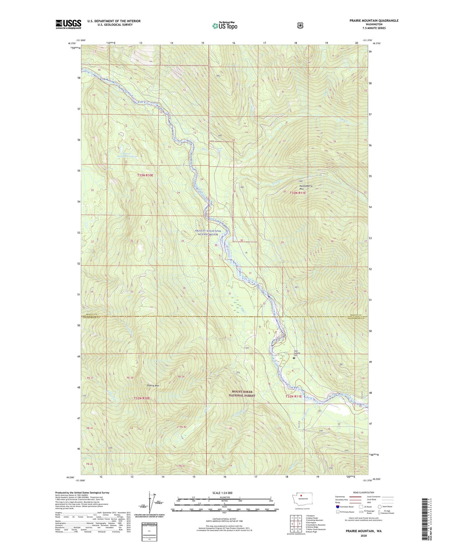
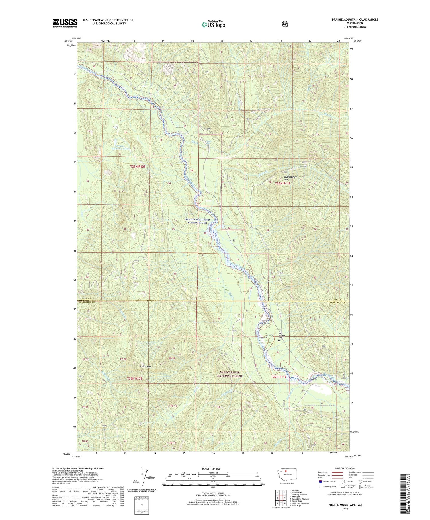
Prairie Mountain Washington US Topo Map
Couldn't load pickup availability
Also explore the Prairie Mountain Forest Service Topo of this same quad for updated USFS data
2023 topographic map quadrangle Prairie Mountain in the state of Washington. Scale: 1:24000. Based on the newly updated USGS 7.5' US Topo map series, this map is in the following counties: Skagit, Snohomish. The map contains contour data, water features, and other items you are used to seeing on USGS maps, but also has updated roads and other features. This is the next generation of topographic maps. Printed on high-quality waterproof paper with UV fade-resistant inks.
Quads adjacent to this one:
West: Darrington
Northwest: Rockport
North: Illabot Peaks
Northeast: Snowking Mountain
East: Huckleberry Mountain
Southeast: Mount Pugh
South: White Chuck Mountain
Southwest: Helena Ridge
This map covers the same area as the classic USGS quad with code o48121c4.
Contains the following named places: All Creek, Big Creek, Black Creek, Conrad Creek, Dearinger Campground, Grade Creek, Jug Creek, Prairie Mountain, Prairie Mountain Lakes, Straight Creek, Suiattle Cemetery, Target Lake, Teepee Falls, Tenas Creek