MyTopo
Kachess Lake Washington US Topo Map
Couldn't load pickup availability
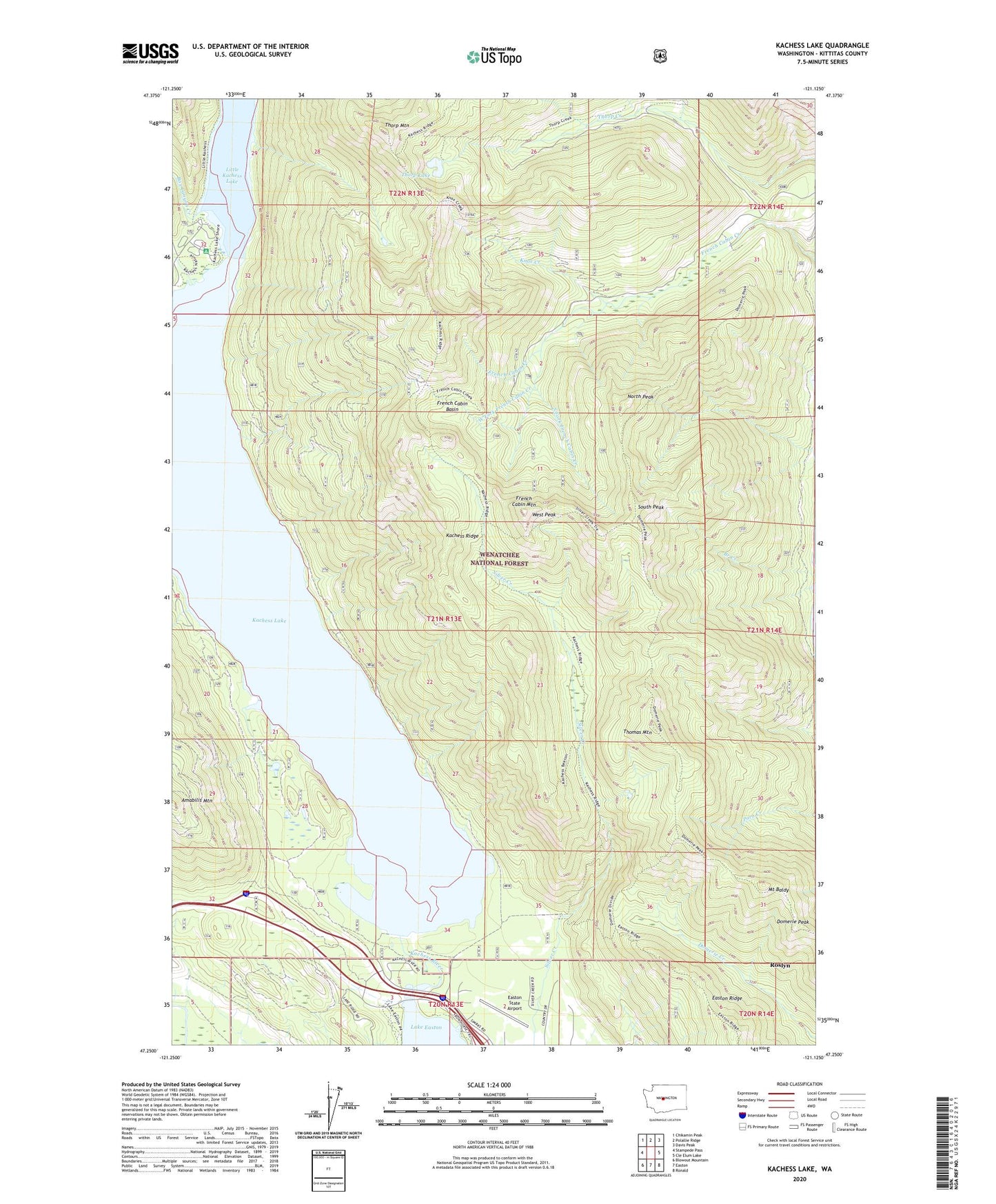
2020 topographic map quadrangle Kachess Lake in the state of Washington. Scale: 1:24000. Based on the newly updated USGS 7.5' US Topo map series, this map is in the following counties: Kittitas. The map contains contour data, water features, and other items you are used to seeing on USGS maps, but also has updated roads and other features. This is the next generation of topographic maps. Printed on high-quality waterproof paper with UV fade-resistant inks.
Quads adjacent to this one:
West: Stampede Pass
Northwest: Chikamin Peak
North: Polallie Ridge
Northeast: Davis Peak
East: Cle Elum Lake
Southeast: Ronald
South: Easton
Southwest: Blowout Mountain
Contains the following named places: Box Canyon Creek, Branch Creek, City of Roslyn, Domerie Peak, Domerie Peak Trail, Easton Ridge, Easton Sno-Park, Easton State Airport, Forest Camp Kachess, French Cabin Basin, French Cabin Mountain, Gale Creek, Hudson Creek, Kachess Campground, Kachess Dam, Kachess Lake, Kachess Ridge, Kachess Ridge Trail, Kachess River, Kittitas County Fire District 8 Station 81, Knox Creek, Lake Easton State Park, Mount Baldy, North Peak, South Fork French Cabin Creek, South Peak, Thomas Mountain, Thorp Lake, Thorp Mountain, Thorp Mountain Lookout, West Fork French Cabin Creek, West Peak